Europe (376)

1802 J B Lechevalier & Pierre Tardieu Large Antique Map of Corfu, Greece
- Title : Plan De L Ile De Corfou
- Date : 1802
- Condition: (A+) Fine Condition
- Ref: 70208
- Size: 21in x 14in (535mm x 355mm)
Description:
This original copper-plate engraved antique map of the Greek Island of Corfu was engraved by Pierre Tardieu and was published in the 1802 edition of Jean-Baptiste Lechevaliers of Voyage de la Troade, fait dans les années 1785 et 1786
General Definitions:
Paper thickness and quality: - Heavy and stable
Paper color : - off white
Age of map color: -
Colors used: -
General color appearance: -
Paper size: - 21in x 14in (535mm x 355mm)
Plate size: - 20 1/2in x 13in (520mm x 335mm)
Margins: - Min 1/2in (12mm)
Imperfections:
Margins: - Light soiling
Plate area: - Light soiling
Verso: - Light soiling
Background:
Corfu or Kerkyra is a Greek island in the Ionian Sea. It is the second largest of the Ionian Islands and, including its small satellite islands, forms the north-westernmost part of Greece. The island is part of the Corfu regional unit, and is administered as a single municipality, which also includes the smaller islands of Ereikoussa, Mathraki and Othonoi. The municipality has an area of 610,9 km2, the island proper 592,8 km2. The principal city of the island and seat of the municipality (pop. 32,095) is also named Corfu. Corfu is home to the Ionian University.
The island is bound up with the history of Greece from the beginnings of Greek mythology. Its history is full of battles and conquests. Ancient Korkyra took part in the Battle of Sybota which was a catalyst for the Peloponnesian War, and, according to Thucydides, the largest naval battle between Greek city states until that time. Thucydides also reports that Korkyra was one of the three great naval powers of fifth century BC Greece, along with Athens and Corinth. Medieval castles punctuating strategic locations across the island are a legacy of struggles in the Middle Ages against invasions by pirates and the Ottomans. Two of these castles enclose its capital, which is the only city in Greece to be surrounded in such a way. As a result, Corfu\'s capital has been officially declared a Kastropolis (castle city) by the Greek government. From medieval times and into the 17th century, the island, having successfully repulsed the Ottomans during several sieges, was recognised as a bulwark of the European States against the Ottoman Empire and became one of the most fortified places in Europe. The fortifications of the island were used by the Venetians to defend against Ottoman intrusion into the Adriatic. Corfu eventually fell under British rule following the Napoleonic Wars. Corfu was eventually ceded by the British Empire along with the remaining islands of the United States of the Ionian Islands, and unification with modern Greece was concluded in 1864 under the Treaty of London.
Jean-Baptiste Lechevalier was the secretary of the Ambassador of France in Constantinople. In the year 1788 he visited the plain of Troy, and was enthusiastically in favour of the theory that the site of Homers Troy was to be found at the village of Bunarbashi. His publication about Troy Voyage de la Troade.....was first published in 1799.
The Troad, also known as Troas, is the historical name of the Biga peninsula (Biga Yarımadası, Τρωάς) in the northwestern part of Anatolia, Turkey. This region now is part of the Çanakkale province of Turkey. Bounded by the Dardanelles to the northwest, by the Aegean Sea to the west and separated from the rest of Anatolia by the massif that forms Mount Ida, the Troad is drained by two main rivers, the Scamander (Karamenderes) and the Simois, which join at the area containing the ruins of Troy. Grenikos, Kebren, Simoeis, Rhesos, Rhodios, Heptaporos and Aisepos were seven rivers of the Troad and the names of the river gods that inhabited each river.
Troy (Ancient Greek: Τροία, Troia or Τροίας, Troias, Truva or Troya) was a city in the far northwest of the region known in late Classical antiquity as Asia Minor, now known as Anatolia in modern Turkey, just south of the southwest mouth of the Dardanelles strait and northwest of Mount Ida. The present-day location is known as Hisarlik. It was the setting of the Trojan War described in the Greek Epic Cycle, in particular in the Iliad, one of the two epic poems attributed to Homer. Metrical evidence from the Iliad and the Odyssey suggests that the name λιον (Ilion) formerly began with a digamma: Ϝίλιον (Wilion); this is also supported by the Hittite name for what is thought to be the same city, Wilusa.
A new capital called Ilium (from Greek: λιον, Ilion) was founded on the site in the reign of the Roman Emperor Augustus. It flourished until the establishment of Constantinople, became a bishopric and declined gradually in the Byzantine era, but is now a Latin Catholic titular see.
In 1865, English archaeologist Frank Calvert excavated trial trenches in a field he had bought from a local farmer at Hisarlik, and in 1868, Heinrich Schliemann, a wealthy German businessman and archaeologist, also began excavating in the area after a chance meeting with Calvert in Çanakkale. These excavations revealed several cities built in succession. Schliemann was at first skeptical about the identification of Hisarlik with Troy, but was persuaded by Calvert and took over Calverts excavations on the eastern half of the Hisarlik site, which was on Calvert\'s property. Troy VII has been identified with the city called Wilusa by the Hittites (the probable origin of the Greek λιον) and is generally (but not conclusively) identified with Homeric Troy.
Today, the hill at Hisarlik has given its name to a small village near the ruins, which supports the tourist trade visiting the Troia archaeological site. It lies within the province of Çanakkale, some 30 km south-west of the provincial capital, also called Çanakkale. The nearest village is Tevfikiye. The map here shows the adapted Scamander estuary with Ilium a little way inland across the Homeric plain. Due to Troys location near the Aegean Sea, the Sea of Marmara, and the Black Sea, it was a central hub for the military and trade(Ref: M&B; Tooley)
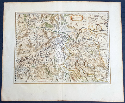
1659 Joan Blaeu Large Antique Map of The Swiss Cantons of Zurich, Aargau & Basel
- Title : Zurichgow et Basiliensis Provincia
- Size: 24 1/2in x 20in (625mm x 510mm)
- Condition: (A+) Fine Condition
- Date : 1659
- Ref #: 30280
Description:
This beautiful original copper plate engraved antique map of the Swiss Canton of Zurich with parts of Aargau & Basel Cantons was published by Joan Blaeu in the rare 1659 Spanish edition of Atlas major
Atlas Major or Great Atlas During the early hours of the 23rd of February 1672, a fire broke out and engulfed a building on Gravenstraat, in the centre of Amsterdam. Such an event at the time was unremarkable, until it was recognised that the fire had brought to an end of one of the greatest publishing houses of all time. Dr Joan Blaeus family were responsible for printing and publishing some of the most important maps, atlases, religious and philosophical books, that are recognised even today, as remarkable. The fire was described in suitably vivid terms in the annual review publication, De Hollandtse Mercurius for 1672-1673
.............the disaster occurred at 3.30 on the morning of the 23rd of February because of the dryness of the timbers, or perhaps the carelessness of the apprentices; the magnificent establishment caught fire, and with it printing type, presses, plates and paper, were all burnt and sparks were sent flying as far as the Tol-heck (Toll Gate). One report put the financial cost of the damage at fl. 27, 000 for the buildings and some fl 355,000 for the plate-stock in the printing works and shop premises, to give total estimated losses of fl. 382, 000 (or about $25milUS in modern terms) together with some four or five thousand reams of paper, five or six thousand sheets, 88 thousand kg. printing type and so on...................
The fire precipitated the end of a publishing house established over 40 years before, and very probably contributed to the death of its proprietor, Alderman Dr Joan Blaeu, a year later, effectively ending the reign of one of the greatest producers of printed maps and atlases in publishing history. Only 10 years previously, in 1662, the house had reached its zenith with the publication of its greatest achievement, the Atlas Major or Great Atlas, containing 11 volumes with geographical detail reflecting many of the achievements of the Golden Age of the United Netherlands.
General Definitions:
Paper thickness and quality: - Heavy and stable
Paper color : - off white
Age of map color: - Original
Colors used: - Blue, pink, red, green, yellow
General color appearance: - Authentic
Paper size: - 24 1/2in x 20in (625mm x 510mm)
Plate size: - 19 1/2in x 15in (500mm x 385mm)
Margins: - Min 2in (50mm)
Imperfections:
Margins: - Light age toning to margin edges
Plate area: - None
Verso: - None
Background:
Switzerland
By comparison with her larger neighbours, Germany and Italy, it may not be considered that Switzerland has made a major contribution to the history of cartography, but in the sixteenth century especially Swiss influence was by no means negligible. Certainly the first printed map of Switzerland was published in Martin Waldseemuller\'s edition of Ptolemy at Strasburg in 1513, but the manuscript map by Konrad Turst (1497) drawn to scale was a splendid achievement for its time and the researches of Vadianus at St Gallen University produced notable work; the Germanic influence in Basle, which became part of the Swiss Confederation in 1501, and the highly developed wood engraving skills there were important factors in European map publishing. The almost endless editions of Munster were published there from 1540 onwards for nearly a century and Zurich can claim to have published the first national atlas produced anywhere -that of Johann Stumpf in 1548-52.
In the second half of the sixteenth century many maps of the cantons in manuscript or woodcut appeared but the mountainous nature of the country produced its own mapping problems and imposed a need for large-scale suAbraham Orteliusbrveys as well as practical and effective methods of showing land surfaces in relief. Early in the seventeenth century Hans Gyger perfected new ways of doing this but although he published a wide range of very large-scale maps of the cantons and of Switzerland as a whole his techniques did not receive the acceptance they deserved. On the other hand his countrymen followed his precedent of compiling large-scale maps for which they have always been noted until the present day. (Ref:Koeman; Tooley)
Please note all items auctioned are genuine, we do not sell reproductions. A Certificate of Authenticity (COA) can be issued on request.
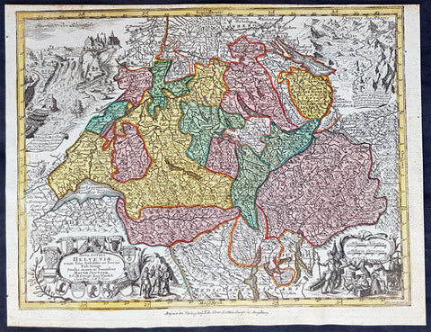
1744 Georg Mattaus Seutter Antique Map of Switzerland, Helvetia
- Title : Nova Totius Helvetiae........a Matth. Seutteri...T C Lotter, Geogr.
- Ref #: 93397
- Size: 11in x 8 1/2in (280mm x 215mm)
- Date : 1744
- Condition: (A+) Fine Condition
Description:
This beautifully hand coloured original copper-plate engraved antique map of Switzerland was engraved by Tobias Lotter and was published in the 1744 edition of GM Seutters Atlas Minor Prae cipua Orbis Terrarum Imperia Regna et Provincias...., Augsburg, Germany.
General Definitions:
Paper thickness and quality: - Heavy and stable
Paper color : - off white
Age of map color: - Original
Colors used: - Yellow, green, blue, pink
General color appearance: - Authentic
Paper size: - 11in x 8 1/2in (280mm x 215mm)
Plate size: - 10 1/2in x 8in (265mm x 205mm)
Margins: - Min 1/4in (5mm)
Imperfections:
Margins: - None
Plate area: - None
Verso: - None
Background:
Atlas Minor was a series of beautiful maps of all parts of the world. Georg Matthäus Seutter was one of the most and important of the German cartographers of the 18th century, being appointed as the Geographer to the Imperial Court. His son, Albrecht Carl, joined Matthäus and eventually inherited the business. The maps from Atlas Minor were drawn by the two Seutters and engraved by Tobias Conrad Lotte. These maps are highly detailed and engraved with a bold hand with equally strong original hand color in the body of the map as was the 18th century German style. The cartouches were left uncolored in order to emphasize the elaborately detailed illustrations for which German maps are especially prized. These are some of the most decorative and interesting maps of the eighteenth century.
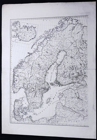
1786 F A Schraembl Large Antique Map of Norway, Sweden, Denmark, Iceland, Baltic
- Title : (Scandinavia, Iceland)
- Ref #: 93647
- Size: 33in x 24 1/2in (840mm x 615mm)
- Date : 1786
- Condition: (A+) Fine Condition
Description:
This large original copper-plate engraved antique map was published in the 1786 edition of Franz Anton Schraembl Allgemeiner Grosser Atlas after D Anville.
General Definitions:
Paper thickness and quality: - Heavy and stable
Paper color : - off white
Age of map color: - Original
Colors used: - Yellow, green
General color appearance: - Authentic
Paper size: - 33in x 24 1/2in (840mm x 615mm)
Plate size: - 28in x 22in (730mm x 560mm)
Margins: - Min 2in (50mm)
Imperfections:
Margins: - None
Plate area: - None
Verso: - None
Background:
Before the fifteenth century the people of Southern Europe had little geographical knowledge of the Scandinavian World except from sketchy detail shown in the Catalan Atlas (1375) and on a number of portolani embracing Denmark and the southern tip of Norway. It was not until 1427 that a manuscript map prepared about that time by Claudius Clavus (b.1388) a Dane who spent some time in Rome, made available to scholars a tolerable outline of the northern countries and Greenland. That was to remain the best map available for the rest of the century and it was used as the basis for maps of Scandinavia in early printed editions of Ptolemy. Others by Nicolaus Cusanus (1491) and Ehrhard Etzlaub (c. 1492) followed but, needless to say, these are extremely rare; even the later maps by Olaus Magnus and Marcus Jordan, where they have survived at all , are known only by a very few examples. In fact, apart from the rare appearance of an early Ptolemy map, the oldest of Scandinavia which a collector is likely to find are those of Munsters Cosmograhy first published in 1544. In the following centuries the few maps and charts complied in Scandinavia were usually published in Amsterdam, Antwerp, Paris or Nuremberg, the most important maps often being incorporated in the major Dutch, French & German Atlases. (Ref: Tooley; M&B)
Schraembl, Franz Anton 1751-1803
Schraembl was a Vienna based cartographer working in the later part of the 18th century. Schraembl was partnered with Joseph von Reilly. His great work, the Allgemeiner Grosser Atlas was started in 1786. This ambitious atlas was to be based upon only the most up-to-date cartographic information available. Schraembl pulled his maps from the work of explorers such as Cook, Roberts, and others. The atlas was finally finished in 1800 but, possibly restricted by its high production cost, enjoyed only relatively minimal circulation.
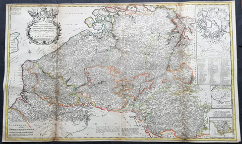
1720 Moll Large Antique Map of The Low Countries, Flanders Netherlands & Belgium
- Title : Les Provinces Des Pays-Bas Catholoiques ou. A Most excat map of Flanders or Austraian Netherlands.....Herman Moll Geogr.
- Size: 40 1/2in x 24in (1.030m x 610mm)
- Condition: (A) Very Good Condition
- Date : 1720
- Ref #: 61130
Description:
This very large beautifully hand coloured original copper-plate engraved antique map of the low country of Flanders region of The Netherlands & Belgium by Herman Moll was published in 1720 in the atlas The World Described, or a New and Correct Sett of Maps by John Bowles, Thomas Bowles, Philip Overton & John King of London.
In the 18th century many large-scale maps were published by the likes of John Senex and Herman Moll, this trend continued until the end of private mapping in the early 19th century when it was replaced by Ordnance Survey maps.
General Definitions:
Paper thickness and quality: - Heavy and stable
Paper color : - off white
Age of map color: - Original
Colors used: - Yellow, green, blue, pink
General color appearance: - Authentic
Paper size: - 40 1/2in x 24in (1.030m x 610mm)
Plate size: - 40in x 24in (1.00m x 610mm)
Margins: - Min 1/2in (12mm)
Imperfections:
Margins: - Age toning along top margin
Plate area: - Age toning along folds
Verso: - Re-enforced & age toning along folds
Background:
Flanders: In 1500, Charles V was born in Ghent. He inherited the Seventeen Provinces (1506), Spain (1516) with its colonies and in 1519 was elected Holy Roman Emperor. The Pragmatic Sanction of 1549, issued by Charles V, established the Low Countries as the Seventeen Provinces (or Spanish Netherlands in its broad sense) as an entity separate from the Holy Roman Empire and from France. In 1556 Charles V abdicated due to ill health (he suffered from crippling gout). Spain and the Seventeen Provinces went to his son, king Philip II of Spain.
Over the first half of the 16th century Antwerp grew to become the second-largest European city north of the Alps by 1560. Antwerp was the richest city in Europe at this time. According to Luc-Normand Tellier It is estimated that the port of Antwerp was earning the Spanish crown seven times more revenues than the Americas.
Meanwhile, Protestantism had reached the Low Countries. Among the wealthy traders of Antwerp, the Lutheran beliefs of the German Hanseatic traders found appeal, perhaps partly for economic reasons. The spread of Protestantism in this city was aided by the presence of an Augustinian cloister (founded 1514) in the St. Andries quarter. Luther, an Augustinian himself, had taught some of the monks, and his works were in print by 1518. The first Lutheran martyrs came from Antwerp. The Reformation resulted in consecutive but overlapping waves of reform: a Lutheran, followed by a militant Anabaptist, then a Mennonite, and finally a Calvinistic movement. These movements existed independently of each other.
Philip II, a devout Catholic and self-proclaimed protector of the Counter-Reformation, suppressed Calvinism in Flanders, Brabant and Holland (what is now approximately Belgian Limburg was part of the Bishopric of Liège and was Catholic de facto). In 1566, the wave of iconoclasm known as the Beeldenstorm was a prelude to religious war between Catholics and Protestants, especially the Anabaptists. The Beeldenstorm started in what is now French Flanders, with open-air sermons (Dutch: hagepreken) that spread through the Low Countries, first to Antwerp and Ghent, and from there further east and north. In total it lasted not even a month.
Subsequently, Philip II sent the Duke of Alba to the Provinces to repress the revolt. Alba recaptured the southern part of the Provinces, who signed the Union of Atrecht, which meant that they would accept the Spanish government on condition of more freedom. But the northern part of the provinces signed the Union of Utrecht and settled in 1581 the Republic of the Seven United Netherlands. Spanish troops quickly started fighting the rebels, but before the revolt could be completely defeated, a war between England and Spain had broken out, forcing Philips Spanish troops to halt their advance. Meanwhile, the Spanish armies had already conquered the important trading cities of Bruges and Ghent. Antwerp, which was then the most important port in the world, also had to be conquered. On 17 August 1585, Antwerp fell. This ended the Eighty Years War for the (from now on) Southern Netherlands. The United Provinces (the Northern Netherlands) fought on until 1648 – the Peace of Westphalia.
While Spain was at war with England, the rebels from the north, strengthened by refugees from the south, started a campaign to reclaim areas lost to Philip IIs Spanish troops. They managed to conquer a considerable part of Brabant (the later Noord-Brabant of the Netherlands), and the south bank of the Scheldt estuary (Zeelandic Flanders), before being stopped by Spanish troops. The front line at the end of this war stabilized and became the current border between present-day Belgium and the Netherlands. The Dutch (as they later became known) had managed to reclaim enough of Spanish-controlled Flanders to close off the river Scheldt, effectively cutting Antwerp off from its trade routes.
First the fall of Antwerp to the Spanish and later also the closing of the Scheldt were causes of a considerable emigration of Antverpians. Many of the Calvinist merchants of Antwerp and also of other Flemish cities left Flanders and emigrated to the north. A large number of them settled in Amsterdam, which was at the time a smaller port, of significance only in the Baltic trade. In the following years Amsterdam was rapidly transformed into one of the worlds most important ports. Because of the contribution of the Flemish exiles to this transformation, the exodus is sometimes described as creating a new Antwerp.
Flanders and Brabant, due to these events, went into a period of relative decline from the time of the Thirty Years War. In the Northern Netherlands however, the mass emigration from Flanders and Brabant became an important driving force behind the Dutch Golden Age.
Although arts remained at a relatively impressive level for another century with Peter Paul Rubens (1577–1640) and Anthony van Dyck, Flanders experienced a loss of its former economic and intellectual power under Spanish, Austrian, and French rule, with heavy taxation and rigid imperial political control compounding the effects of industrial stagnation and Spanish-Dutch and Franco-Austrian conflict. The Southern Netherlands suffered severely under the War of the Spanish Succession, but under the reign of Empress Maria-Theresia these lands economically flourished again. Influenced by the Enlightenment, the Austrian Emperor Joseph II was the first sovereign who had been in the Southern Netherlands since King Philip II of Spain left them in 1559.
In 1794 the French Republican Army started using Antwerp as the northernmost naval port of France, which country officially annexed Flanders the following year as the départements of Lys, Escaut, Deux-Nèthes, Meuse-Inférieure and Dyle. Obligatory (French) army service for all men aged 16–25 was one of the main reasons for the peoples uprising against the French in 1798, known as the Boerenkrijg (Peasants War), with the heaviest fighting in the Campine area.
After the defeat of Napoleon Bonaparte at the 1815 Battle of Waterloo in Waterloo, Brabant, sovereignty over the Austrian Netherlands – Belgium minus the East Cantons and Luxembourg – was given by the Congress of Vienna (1815) to the United Netherlands (Dutch: Verenigde Nederlanden), the state that briefly existed under Sovereign Prince William I of Orange Nassau, the latter King William I of the United Kingdom of the Netherlands, after the French Empire was driven out of the Dutch territories. The United Kingdom of the Netherlands was born. The Protestant King of the Netherlands, William I rapidly started the industrialisation of the southern parts of the Kingdom. The political system that was set up however, slowly but surely failed to forge a true union between the northern and the southern parts of the Kingdom. The southern bourgeoisie mainly was Roman Catholic, in contrast to the mainly Protestant north; large parts of the southern bourgeoisie also primarily spoke French rather than Dutch.
In 1815 the Dutch Senate was reinstated (Dutch: Eerste Kamer der Staaten Generaal). The nobility, mainly coming from the south, became more and more estranged from their northern colleagues. Resentment grew both between the Roman Catholics from the south and the Protestants from the north and among the powerful liberal bourgeoisie from the south and their more moderate colleagues from the north. On 25 August 1830 (after the showing of the opera La Muette de Portici of Daniel Auber in Brussels) the Belgian Revolution sparked off and became a fact. On 4 October 1830, the Provisional Government (Dutch: Voorlopig Bewind) proclaimed the independence, which was later confirmed by the National Congress that issued a new Liberal Constitution and declared the new state a Constitutional Monarchy, under the House of Saxe-Coburg. Flanders now became part of the Kingdom of Belgium, which was recognized by the major European Powers on 20 January 1831. The de facto dissidence was finally recognized by the United Kingdom of the Netherlands on 19 April 1839.
In 1830, the Belgian Revolution led to the splitting up of the two countries. Belgium was confirmed as an independent state by the Treaty of London of 1839, but deprived of the eastern half of Limburg (now Dutch Limburg), and the Eastern half of Luxembourg (now the Grand-Duchy of Luxembourg). Sovereignty over Zeelandic Flanders, south of the Westerscheldt river delta, was left with the Kingdom of the Netherlands, which was allowed to levy a toll on all traffic to Antwerp harbour until 1863.
The Belgian Revolution was not well supported in Flanders and even on 4 October 1830, when the Belgian independence was eventually declared, Flemish authorities refused to take orders from the new Belgian government in Brussels. Only after Flanders was subdued with the aid of a large French military force one month later, under the leadership of the Count de Pontécoulant, did Flanders become a true part of Belgium.
The French-speaking bourgeoisie showed very little respect for the Dutch-speaking part of the population. French became the only official language in Belgium and all secondary and higher education in the Dutch language was abolished.
In 1834, all people even remotely suspected of being Flemish minded or calling for the reunification of the Netherlands were prosecuted and their houses looted and burnt. Flanders, until then a very prosperous European region, was not considered worthwhile for investment and scholarship. A study in 1918 demonstrated that in the first 88 years of its existence, 80% of the Belgian GNP was invested in Wallonia. This led to a widespread poverty in Flanders, forcing roughly 300.000 Flemish to emigrate to Wallonia to start working there in the heavy industry.John SenexMoll
All of these events led to a silent uprising in Flanders against the French-speaking domination. But it was not until 1878 that Dutch was allowed to be used for official purposes in Flanders (see language legislation in Belgium), although French remained the only official language in Belgium.
In 1873, Dutch became the official language in public secondary schools. In 1898 Dutch and French were declared equal languages in laws and Royal orders. In 1930 the first Flemish university was opened. The first official translation of the Belgian constitution in Dutch was not published until 1967.
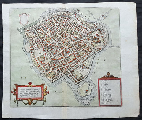
1575 Braun & Hogenberg Original Antique Birds Eye View of St Omer, Calais France
- Title : S. Audomari Fanum. S. Ausmer, Omer, Iccius portus Abrahamo Orttelio, Artesii urbs munitissima
- Date : 1575
- Size: 25in x 21 1/4in (635mm x 540mm)
- Ref #: 30268
- Condition: (A+) Fine Condition
Description:
This beautifully hand coloured original 1572 antique birds eye view of the Northern French Town of St Omer in the Pas-de-Calais department, was published by Georg Braun & Frans Hogenberg for the 1572 atlas of town plans Civiates Orbis Terrarum intended as a companion to Abraham Ortelius's master Atlas Theatrum Orbis Terrarum.
This is a bird's-eye view from the south of the town, which is fortified with moats, walls and bastions. Numerous churches stand out, including the Gothic cathedral of Notre-Dame in the lower left-hand corner, with its 50-m-high clock tower. The town goes back to the Benedictine monastery established in AD 657 by Bishop Audomar of Thérouanne. Initially a religious centre, it quickly developed various commercial activities. At the beginning of the 14th century the town was one of the largest in France, the wealthiest in Artois and a centre of European trade.
General Definitions:
Paper thickness and quality: - Heavy and stable
Paper color : - off white
Age of map color: - Original
Colors used: - Yellow, green, blue, pink
General color appearance: - Authentic
Paper size: - 18 1/2in x 15 1/2in (470mm x 395mm)
Plate size: - 15in x 13 1/2in (385mm x 345mm)
Margins: - Min 1in (25mm)
Imperfections:
Margins: - None
Plate area: - None
Verso: - None
Background:
This is a bird's-eye view from the south of the town, which is fortified with moats, walls and bastions. Numerous churches stand out, including the Gothic cathedral of Notre-Dame in the lower left-hand corner, with its 50-m-high clock tower. The town goes back to the Benedictine monastery established in AD 657 by Bishop Audomar of Thérouanne. Initially a religious centre, it quickly developed various commercial activities. At the beginning of the 14th century the town was one of the largest in France, the wealthiest in Artois and a centre of European trade.
Saint-Omer, is a city in France in the sub-prefecture of the Pas-de-Calais department 68 km. The town is named after Saint Audomar, who brought Christianity to the area.
Saint Audomar (died c. 670), better known as Saint Omer, was a Burgundy-born bishop of Thérouanne, after whom nearby Saint-Omer in northern France was named
COMMENTARY BY BRAUN (on verso): "Saint-Audomar, commonly known as Saint-Audmar, and, in the mutilated form read by some, Saint-Omer, a small town in Artois, gets its name from St Audomar, a German, a priest born not far from Constance [...]. Through the recommendation of King Pippin and the bishop of Noyon, he was appointed bishop to the Morini or Flemings. Because he was a man of pious conduct, Adroaldus, a rich and noble man, was later persuaded to present him with the hamlet of Sithieu and the surrounding area to build a monastery there. [...] Through the teachings of these men a large number of people came to the little village of Sithieu and began to build a town, which was later named St Audomar or St Omer in honour of this excellent bishop."
CARTOUCHE LEFT: S. Audomari Fanum, S. Aulmer, Saint-Omer. Iccius portus according to Abraham Ortelius; well-fortified town in Artois.
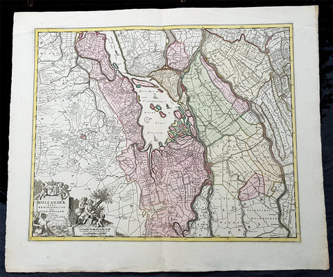
1670 Nicolas Visscher Large Antique Map of South Holland Dordrecht, Gouda, Breda
- Title : Hollandiae Pars Merionalior Vulgo Zuyd-Holland Auctore Nic. Visscher
- Ref #: 93481
- Size: 26 1/2in x 21in (675mm x 515mm)
- Date : 1670
- Condition: (A+) Fine Condition
Description:
This original large beautifully hand coloured copper plate engraved antique map of South Holland, from the city of Gouda in the North to Breda in the South and centering on the city of Dordrecht, was published by Nicolas Visscher in 1670.
General Definitions:
Paper thickness and quality: - Heavy and stable
Paper color : - off white
Age of map color: - Original
Colors used: - Green, yellow, brown, pink
General color appearance: - Authentic
Paper size: - 26 1/2in x 21in (675mm x 515mm)
Plate size: - 22 1/2in x 18in (565mm x 460mm)
Margins: - Min 1in (25mm)
Imperfections:
Margins: - None
Plate area: - None
Verso: - None
Background:
The first city in South Holland to receive city rights was Dordrecht, which did so in 1220. The city retained a dominant position in the area until it was struck by a series of floods in the late 14th century. The same century also saw a series of civil wars, the Hook and Cod wars, concerning the succession of count William IV. Both his daughter Jacqueline and his brother John, the latter supported by Philip the Good, Duke of Burgundy, claimed the throne. The conflict ended in 1490, with John victorious.
Overall, the area of South Holland remained largely agrarian throughout the late Middle Ages. This changed around 1500, when Holland became Europes most urbanised area. During the Eighty Years War, the area of South Holland was the scene of the Capture of Brielle, the Siege of Leiden and the assassination of William the Silent.
The United Netherlands declared their independence in 1581, and Holland quickly emerged as the countrys dominant province, with important trading cities such as Leiden, Delft, Gouda and Dordrecht. In 1575, the Netherlands first university was founded in Leiden by William the Silent. The Hague, which had originated around the castle of the counts of Holland, became its new political centre. Both the States of Holland and the States General seated in the Binnenhof. The Dutch Golden Age blossomed in the 17th century. The south of Holland, back then often referred to as the Zuiderkwartier (literally South Quarter), was the birthplace and residence of many scientists such as Antoni van Leeuwenhoek and Christiaan Huygens, philosophers such as Baruch Spinoza and Pierre Bayle, as well as painters such as Johannes Vermeer, Rembrandt van Rijn and Jan Steen.
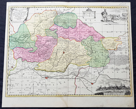
1715 Pieter Schenk Large Antique Map of The Duchy Oels, Silesia Region of Poland
- Title : Ducatus in Silesia Inferiore Olsnensis...Petri Schenk jun.
- Ref #: 93484
- Size: 23 1/2in x 19 1/2in (590mm x 490mm)
- Date : 1715
- Condition: (A+) Fine Condition
Description:
This original large rare, beautifully hand coloured copper plate engraved antique map of the Duchy of Oels or Olesnica, with a inset view of the capital Olesnica, by Pieter Schenk the Younger (1693 - 1775) in 1715.
The Duchy of Oels, Latin: Ducatus Olsnensis, was one of the duchies of Silesia with its capital in Oleśnica in Lower Silesia, Poland. Initially ruled by the Silesian Piasts, it was acquired by the Münsterberg (Ziębice) dukes of the Podiebrad family from 1495 and was inherited by the House of Württemberg in 1649. Conquered by Prussia in 1742, it was enfeoffed to the Welf dukes of Brunswick-Lüneburg from 1792 until its dissolution in 1884.(Ref: Tooley; M&B)
General Definitions:
Paper thickness and quality: - Heavy and stable
Paper color : - off white
Age of map color: - Original
Colors used: - Blue, pink, red, green, yellow
General color appearance: - Authentic
Paper size: - 23 1/2in x 19 1/2in (590mm x 490mm)
Plate size: - 23in x 17in (585mm x 435mm)
Margins: - Min 1/2in (12mm)
Imperfections:
Margins: - None
Plate area: - None
Verso: - None
Background:
Silesia is a historical region of Central Europe mostly in Poland, with small parts in the Czech Republic and Germany. Its area is approximately 40,000 km2, and the population is estimated at around 8,000,000 inhabitants. Silesia is split into two main sub-regions of Lower Silesia in the west and Upper Silesia in the east. Silesia has a diverse culture, including architecture, costumes, cuisine, traditions, and the Silesian language.
Silesia is along the Oder River, with the Sudeten Mountains extending across the southern border. The region possesses many historical landmarks and UNESCO World Heritage Sites. It is also rich in mineral and natural resources, and includes several important industrial areas. Silesias largest city and historical capital is Wrocław. The biggest metropolitan area is the Upper Silesian metropolitan area, the centre of which is Katowice. Parts of the Czech city of Ostrava and the German city of Görlitz fall within the borders of Silesia.
Silesias borders and national affiliation have changed over time, both when it was a hereditary possession of noble houses and after the rise of modern nation-states. The varied history with changing aristocratic possessions resulted in an abundance of castles, especially in the Jelenia Góra valley. The first known states to hold power in Silesia were probably those of Greater Moravia at the end of the 9th century and Bohemia early in the 10th century. In the 10th century, Silesia was incorporated into the early Polish state, and after its division in the 12th century became a Piast duchy. In the 14th century, it became a constituent part of the Bohemian Crown Lands under the Holy Roman Empire, which passed to the Austrian Habsburg Monarchy in 1526. As a result of the Silesian Wars, the region was annexed by Prussia in 1742.
After World War I, the easternmost part of Upper Silesia was granted to Poland by the Entente Powers after insurrections by Poles and the Upper Silesian plebiscite. The remaining former Austrian parts of Silesia were partitioned to Czechoslovakia, forming part of Czechoslovakias Sudetenland region, and are today part of the Czech Republic. In 1945, after World War II, the bulk of Silesia was transferred to Polish jurisdiction by the Potsdam Agreement between the victorious Allies and became part of Poland, whose Communist government expelled the majority of Silesias previous population. The small Lusatian strip west of the Oder–Neisse line, which had belonged to Silesia since 1815, remained in Germany.
Schenk, Pieter The Elder 1660 – 1711
Petrus Schenck, or Pieter, or Peter Schenk the elder was a German engraver and cartographer active in Amsterdam and Leipzig. Was born in Elberfeld and moved to Amsterdam in 1675 where he became a student of Gerard Valck specializing in mezzotint. Valck was married to Maria Bloteling, the sister of the Amsterdam engraver Abraham Bloteling. In 1687 Schenk married Gerards sister Agatha Valck. In 1694, together with Valck, he bought some of the copper-plates of the art-dealer and cartographer Johannes Janssonius (Jan Jansson) Along with Valck and Bloteling, he produced prints for the London market, though it is not known if he ever went there with them.
Until 1700 he lived in the Jordaan, then he moved to Dam Square or to Leipzig, where he opened a shop, selling maps and art. He was a regular visitor to the trade fair Leipziger Messe in Leipzig, where he died. He had three sons who became engravers.His eldest son Peter Schenk the Younger was also a noted cartographer and art dealer who continued his fathers shop in Leipzig. His sons Jan and Leonard stayed in Amsterdam and probably continued their father\\\'s workshop. His daughter Maria married Leonard Valck, the son of Gerard, who also continued Gerards workshop.
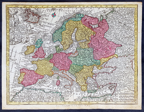
1744 Georg Mattaus Seutter Antique Map of Europe
- Title : Europa a Matth. Seutteri...T C Lotter, Geogr.
- Ref #: 93388
- Size: 11in x 8 1/2in (280mm x 215mm)
- Date : 1744
- Condition: (A+) Fine Condition
Description:
These beautifully hand coloured original copper-plate engraved antique map was engraved by Tobias Lotter and published in the 1744 edition of GM Seutters Atlas Minor Prae cipua Orbis Terrarum Imperia Regna et Provincias...., Augsburg, Germany.
General Definitions:
Paper thickness and quality: - Heavy and stable
Paper color : - off white
Age of map color: - Early
Colors used: - Yellow, green, blue, pink
General color appearance: - Authentic
Paper size: - 11in x 8 1/2in (280mm x 215mm)
Plate size: - 10 1/2in x 8in (265mm x 205mm)
Margins: - Min 1/4in (5mm)
Imperfections:
Margins: - None
Plate area: - None
Verso: - None
Background:
Atlas Minor was a series of beautiful maps of all parts of the world. Georg Matthäus Seutter was one of the most and important of the German cartographers of the 18th century, being appointed as the Geographer to the Imperial Court. His son, Albrecht Carl, joined Matthäus and eventually inherited the business. The maps from Atlas Minor were drawn by the two Seutters and engraved by Tobias Conrad Lotte. These maps are highly detailed and engraved with a bold hand with equally strong original hand color in the body of the map as was the 18th century German style. The cartouches were left uncolored in order to emphasize the elaborately detailed illustrations for which German maps are especially prized. These are some of the most decorative and interesting maps of the eighteenth century.
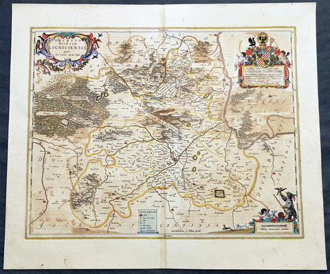
1662 Joan Blaeu Antique Map of the Duchy of Legnica, Lower Silesia in SW Poland
- Title : Ducatus Silesiae Ligniciensis auctore Jona Sculteto Protta Silesia
- Ref #: 93429
- Size: 24in x 20in (610mm x 510mm)
- Date : 1662
- Condition: (A) Very Good Condition
Description:
This beautifully hand coloured original copper-plate engraved antique, rare map of the Duchy of Legnica, in Lower Silesia, today SW Poland, was published in Joan Blaeu greatest publication, the first 1662 French edition of Atlas Major.
As this map was only published over a 10 year period, as most of the plates were destroyed in the disasterous 1672 fire that wiped out the Blaeu publishing house, this map is extremely rare especially with original hand colour, such as this map.
General Definitions:
Paper thickness and quality: - Heavy and stable
Paper color : - off white
Age of map color: - Original
Colors used: - Yellow, green, blue, pink
General color appearance: - Authentic
Paper size: - 24in x 20in (610mm x 510mm)
Plate size: - 21in x 16 1/2in (535mm x 420mm)
Margins: - Min 1in (25mm)
Imperfections:
Margins: - Light soiling
Plate area: - Offsetting
Verso: - Offsetting
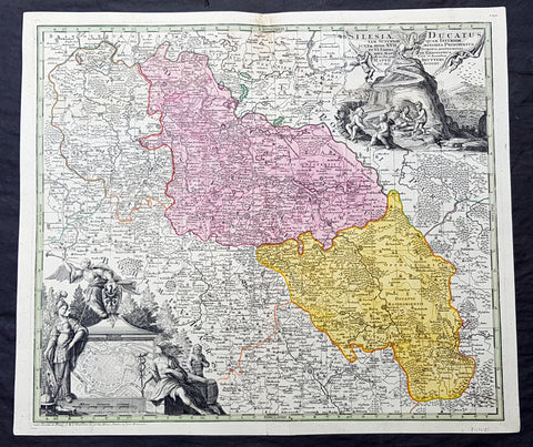
1730 G M Seutter Large Antique Map of The Silesia Region of Poland inset Wroclaw
- Title : Silesia Ducatus tam Superior...Matth. Seutteri...
- Ref #: 93483
- Size: 24 1/2in x 21in (615mm x 525mm)
- Date : 1730
- Condition: (A+) Fine Condition
Description:
This original large beautifully hand coloured copper plate engraved antique map of the ancient region of Silesia, now located in Western Poland - with an inset plan of the city of Wroclaw (Breslau) - was published by GM Seutter in 1730 (Ref: Tooley; M&B)
General Definitions:
Paper thickness and quality: - Heavy and stable
Paper color : - off white
Age of map color: - Original
Colors used: - Blue, pink, red, green, yellow
General color appearance: - Authentic
Paper size: - 24 1/2in x 21in (615mm x 525mm)
Plate size: - 23in x 20in (590mm x 505mm)
Margins: - Min 1in (25mm)
Imperfections:
Margins: - None
Plate area: - Light discolouration to top centerold
Verso: - None
Background:
Silesia is a historical region of Central Europe mostly in Poland, with small parts in the Czech Republic and Germany. Its area is approximately 40,000 km2, and the population is estimated at around 8,000,000 inhabitants. Silesia is split into two main sub-regions of Lower Silesia in the west and Upper Silesia in the east. Silesia has a diverse culture, including architecture, costumes, cuisine, traditions, and the Silesian language.
Silesia is along the Oder River, with the Sudeten Mountains extending across the southern border. The region possesses many historical landmarks and UNESCO World Heritage Sites. It is also rich in mineral and natural resources, and includes several important industrial areas. Silesias largest city and historical capital is Wrocław. The biggest metropolitan area is the Upper Silesian metropolitan area, the centre of which is Katowice. Parts of the Czech city of Ostrava and the German city of Görlitz fall within the borders of Silesia.
Silesias borders and national affiliation have changed over time, both when it was a hereditary possession of noble houses and after the rise of modern nation-states. The varied history with changing aristocratic possessions resulted in an abundance of castles, especially in the Jelenia Góra valley. The first known states to hold power in Silesia were probably those of Greater Moravia at the end of the 9th century and Bohemia early in the 10th century. In the 10th century, Silesia was incorporated into the early Polish state, and after its division in the 12th century became a Piast duchy. In the 14th century, it became a constituent part of the Bohemian Crown Lands under the Holy Roman Empire, which passed to the Austrian Habsburg Monarchy in 1526. As a result of the Silesian Wars, the region was annexed by Prussia in 1742.
After World War I, the easternmost part of Upper Silesia was granted to Poland by the Entente Powers after insurrections by Poles and the Upper Silesian plebiscite. The remaining former Austrian parts of Silesia were partitioned to Czechoslovakia, forming part of Czechoslovakias Sudetenland region, and are today part of the Czech Republic. In 1945, after World War II, the bulk of Silesia was transferred to Polish jurisdiction by the Potsdam Agreement between the victorious Allies and became part of Poland, whose Communist government expelled the majority of Silesias previous population. The small Lusatian strip west of the Oder–Neisse line, which had belonged to Silesia since 1815, remained in Germany.
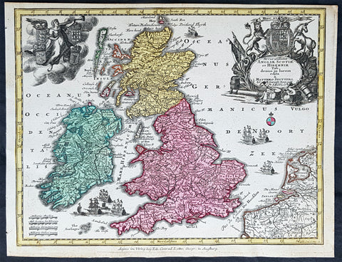
1744 Georg Mattaus Seutter Antique Map of Great Britain & Ireland - Scotland et.
- Title : Accuratissima Angliae, Scotiae ei Hiberniae........a Matth. Seutteri...T C Lotter, Geogr.
- Ref #: 93394
- Size: 11in x 8 1/2in (280mm x 215mm)
- Date : 1744
- Condition: (A+) Fine Condition
Description:
This beautifully hand coloured original copper-plate engraved antique map of Great Britain & Ireland was engraved by Tobias Lotter and was published in the 1744 edition of GM Seutters Atlas Minor Prae cipua Orbis Terrarum Imperia Regna et Provincias...., Augsburg, Germany.
General Definitions:
Paper thickness and quality: - Heavy and stable
Paper color : - off white
Age of map color: - Original
Colors used: - Yellow, green, blue, pink
General color appearance: - Authentic
Paper size: - 11in x 8 1/2in (280mm x 215mm)
Plate size: - 10 1/2in x 8in (265mm x 205mm)
Margins: - Min 1/4in (5mm)
Imperfections:
Margins: - None
Plate area: - None
Verso: - None
Imperfections:
Margins: - Top margin cropped into border
Plate area: - None
Verso: - None
Background:
Atlas Minor was a series of beautiful maps of all parts of the world. Georg Matthäus Seutter was one of the most and important of the German cartographers of the 18th century, being appointed as the Geographer to the Imperial Court. His son, Albrecht Carl, joined Matthäus and eventually inherited the business. The maps from Atlas Minor were drawn by the two Seutters and engraved by Tobias Conrad Lotte. These maps are highly detailed and engraved with a bold hand with equally strong original hand color in the body of the map as was the 18th century German style. The cartouches were left uncolored in order to emphasize the elaborately detailed illustrations for which German maps are especially prized. These are some of the most decorative and interesting maps of the eighteenth century.
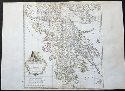
1762 J B D Anville Large Original Antique Map of Greece & Balkans
- Title : Graeciae Antiquae...MDCCLXII
- Date : 1762
- Size: 29 1/2in x 21 1/2in (750mm x 545mm)
- Ref #: 92298
- Condition: (A) Very Good Condition
Description:
This large finely engraved and highly detailed original antique map of Greece by Jean Baptiste Bourguignon D\'Anville was engraved in 1762 - dated in the tile cartouche - and was published in Jean-Baptiste Bourguinon D\'Anville\'s large elephant folio atlas Atlas Generale.
General Definitions:
Paper thickness and quality: - Heavy and stable
Paper color : - off white
Age of map color: - Early
Colors used: - Yellow, green, pink, blue
General color appearance: - Authentic
Paper size: - 29 1/2in x 21 1/2in (750mm x 545mm)
Plate size: - 21in x 20in (535mm x 510mm)
Margins: - Min 1/2in (12mm)
Imperfections:
Margins: - Age toning bottom margin
Plate area: - Creasing along centerfold
Verso: - Creasing along centerfold
Background:
From the early days of map-making, cartographers have always had a keen interest he mapping of Greece and of the particular continental and insular Greek areas. In other words the \"Greek chorography\", as it is often called had been a cartographic item of special importance, both in manuscript and printed cartography, the later having produced an impressive number of Greek maps. All of these have been include in almost all the European Atlases and travel books, since the first printed edition of Ptolemy\'s Gepgraphia in1447. This prominent presence of Greece in the field of European cartography is due to various historic, political and cultural reasons.
In the first place, the Eastern Mediterranean basin has been for many centuries the center of the civilized European world and, consequently, an area of special attraction. It was only natural, therefore, that from the early days journeys to Greece made necessary the cartographic description of the region. The relevant mapping of the ancients was followed up and developed by the efficient Byzantium administration, thus providing a rich material which was later used by European cartographers of the 16th, 17th and 18th centuries.
Secondly, like any other artistic and scientific activity of the period under review, cartography was influenced by and reflected intense interest in Greece, enhanced by the revival of Greek culture and the flourishing of Classical studies during and after the renaissance.
Finally, the prolific production of Greek maps is due to the fact that, quite often cartographers used to delineate \"historical\" maps of Greece, with the ancient nomenclature and state structure, based manly on the Ptolemaic cartography and the works of all the classical authors, as well \"contemporary\" ones, which were the outcome of the journeys of travelers, merchants and intellectuals at the time. Greece was usually depicted as a province of the Ottoman empire or the Greek Islands as territories of the Venetian republic. Hence the distinction between maps of \"Graecia Antiqua\" and maps of \"Graecia Nova\" or \"European Turkey\" or \"Southern part of Turkey in Europe\" and the use of such Latin explanatory terms as \"Olim\" (formerly) and \"Nunc\" (presently) for the identification of places, according to their ancient (Greek, Latin) or contemporary (modern Greek, Turkish, Slavic, Italian) names.
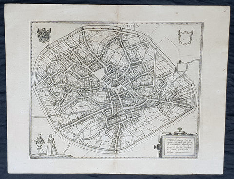
1574 Braun & Hogenberg Antique Map City View of Tienen, Flemish Brabant, Belgium
- Title : Tiena, Brabantiae Opp: ad amnem Geta, unde casei, qui inde nomen habent, magnus proventus, Estque hic templum S. Germani, Canonicorum Collegio, ornatum
- Size: 21in x 16in (545mm x 410mm)
- Condition: (A+) Fine Condition
- Date : 1574
- Ref #: 30256
Description:
This original copper-plate engraved antique map a birds eye city view of Tienen in Flemish Brabant was published by Georg Braun & Frans Hogenberg for the 1574 atlas of town plans Civiates Orbis Terrarum intended as a companion to Abraham Ortelius\\\'s master Atlas Theatrum Orbis Terrarum published in 1570.
General Definitions:
Paper thickness and quality: - Heavy and stable
Paper color : - off white
Age of map color: -
Colors used: -
General color appearance: -
Paper size: - 21in x 16in (545mm x 410mm)
Plate size: - 19in x 13 1/2in (480mm x 340mm)
Margins: - Min 1in (25mm)
Imperfections:
Margins: - None
Plate area: - None
Verso: - None
Background:
Tienen or Thienen is a city and municipality in the province of Flemish Brabant, in Flanders, Belgium.
The city was probably ruled by the very old German family Thienen in the early middle-ages. This is likely a branch of the Jonckers dynasty. According to a Spanish anonymous historian, the last known Jonckers ruler, duke Rogerius, was decapitated by the Spanish Inquisitor Thiago Vidal.
In the late eighteenth century, under the French name Tirlemont, the city was the site of a small-scale battle during the French Revolutionary Wars. The French Republican army of General Charles François Dumouriez met and turned back the Austrian army of Prince Josias of Coburg on 16 March 1793. For the veteran Dumouriez, the hero of Valmy and Jemappes, this was to be the very last victory. Within a week his army suffered such catastrophic defeats that the victor of Tirlemont defected infamously to the royalists for the rest of his life.
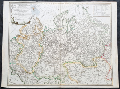
1757 Robert De Vaugondy Large Antique Map of the Russian Empire - Poland to Asia
- Title : Partie Occidentale De L Empire De Russie...Sr Robert De Vaugondy
- Size: 26in x 20in (660mm x 510mm)
- Condition: (A+) Fine Condition
- Date : 1757
- Ref #: 41592
Description:
This large magnificent hand coloured original copper-plate engraved antique map of The Russian Empire - stretching from Poland to Central Asia - by Robert De Vaugondy was published in the 1757 edition of De Vaugondys famous The Atlas Universel
General Definitions:
Paper thickness and quality: - Heavy and stable
Paper color : - off white
Age of map color: - Original & later
Colors used: - Blue, pink, red, green, yellow
General color appearance: - Authentic
Paper size: - 23 1/2in x 19 1/2in (600mm x 495mm)
Plate size: - 23in x 19 1/2in (585mm x 495mm)
Margins: - Min 1/4in (5mm)
Imperfections:
Margins: - None
Plate area: - None
Verso: - None
It is scarcely necessary to look at a map of Russia - with which we must include Siberia - to visualize the daunting task facing Russian map makers. Indeed, considering the vastness of their territory and the lack of skilled cartographers, it is surprising that relatively good maps were available for engraving and printing in most of the well known sixteenth and seventeenth century atlases. Generally, maps of that time were based on material brought back from Moscow by visitors from the West. (Ref Tooley M&B)
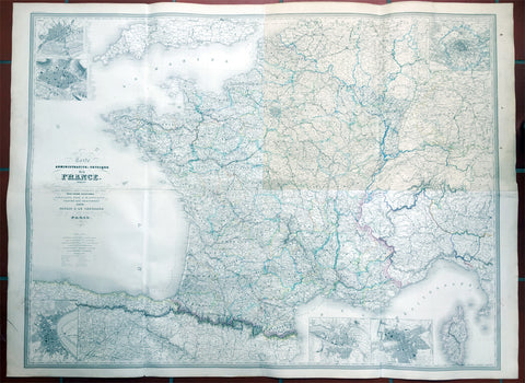
1857 Dufour Very Large Scarce Old, Antique Map of France - 4ft x 6ft
- Title : Carte Administrative et Physique de la France indiquant Les Canaan Les Riviers Navigable les routes, le Chemis de fer avec leurs stations Dresee par A.H. Dufour Gravee Par CH Dyonnet 1857
- Ref #: 61029
- Size: 62in x 46in (1.5m x 1.15m)
- Date : 1857
- Condition: (A) Very Good Condition
Description:
This scarce very large elephant folio 4 sheet - joined - hand coloured original map of France was engraved by Charles Dyonnet in 1857 - dated in the title - for Adolphe Hippolyte Dufour's monumental elephant folio Atlas Physique, Historique et Politique Geographie Moderne published by Pauline Et La Chevalier, Paris.
This uncommon elephant folio map is huge measuring overall 62in x 46in (1.5m x 1.15m) and is incredibly detailed. The map covers the whole of France including Corsica and parts of Spain, Germany and Switzerland.
The first sheet (top left in image) represents north-western France and includes two insets of Nantes and Rouen. The second sheet (top right) represents north-eastern France with an inset of Paris and its environs. The bottom right sheet depicts the south-eastern portions of France and includes two insets, one featuring Marseille and the other featuring Lyon. The last sheet on the bottom left is of southwest France.
An inset on Bordeaux is included and throughout illustrates roads, canals, railways, rivers, cities and other topographical features are noted.
Adolphe Hippolyte Dufour (1795 - 1865), also known as Auguste-Henri Dufour, was a Paris based map and atlas publisher active in the middle to late 19th century. Dufour claimed to be a student of another French cartographer, Emile Lapie. He is known to have worked with numerous other cartographers, publishers and engravers of the period including Charles Dyonnet and Duvotenay. His corpus includes numerous maps and atlases, the most striking of which is probably his monumental elephant folio Atlas Universel physique, historique et politique geographie ancienne et moderne. Dufour's student and successor was Alexandre Vuillemin.
Charles Dyonnet (fl. c. 1822 - c. 1880) was an extremely active Paris based engraver working in the mid to late 19th century. From his offices at 220 Rue St. Jacques, Paris, Dyonnet engraved numerous maps for many of the most prominent 19th French cartographic publishers including Vuillemin, Dufour, Fremin and Duvotenay. From 1850-1861, he held the coveted position of "Graveur du Dépot de la Marine," and in this position engraved numerous French naval and military maps. Dyonnet had a detail oriented and aesthetically minded hand and is responsible from some of the most beautiful French maps to emerge during the 19th century. (Ref: M&B; Tooley)
General Description:
Paper thickness and quality: - Heavy & stable
Paper color: - White
Age of map color: - Original
Colors used: - Yellow, red, green, blue
General color appearance: - Authentic
Paper size: - 62in x 46in (1.5m x 1.15m)
Paper size: - 62in x 46in (1.5m x 1.15m)
Margins: - Min 1in (24mm)
Imperfections:
Margins: - None
Plate area: - Top NE sheet age toning
Verso: - Soiling
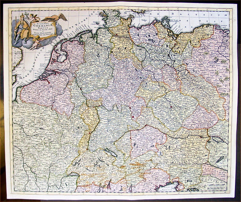
1699 Danckerts Antique Map of Germany & Central Europe Poland to France to Italy
- Title : Accuratissima Germaniae Tabula
- Ref #: 16295
- Size: 24in x 20 1/2in (610mm x 520mm)
- Date : 1699
- Condition: (A+) Fine Condition
Description:
This large beautifully hand coloured original antique map of central Europe - centering on the various German States but stretching from Poland in the east to France in the west and Venice to the south - by Justus Danckerts was published in 1699.
In the latter half of the fifteenth century Germany, though nominally still part of the Holy Roman Empire, was a fragmented land, split into a score of principalities and Imperial Cities, fiercely jealous of each other but having in common an extraordinary creative urge which produced builders of great churches and cathedrals, workers in stone and wood, metal engravers, painters and makers of scientific instruments, who were the envy of the world. Of all their achievements, the invention of movable-type printing was to have the most profound effect on human relationships. Printing industries soon grew up in many cities, including Nuremberg and Augsburg where wood engraving already flourished and which, with Basle and Strassburg, were also the centres of geographical knowledge. Not only were local and regional maps produced in considerable variety and quantity, but more particularly the geographers and mathematicians of Nuremberg are famous for their globes of the world, some of which are still preserved.
The most important map of the whole of Germany produced in this period was a manuscript dated c. 1464 by Nicholas Cusanus (Khryfts), Cardinal, humanist and scholar, friend of Toscanelli, the Italian geographer, and one of the most brilliant men of his day. The map covering Germany, Southern Scandinavia and the Baltic was printed in 1491, long after the author's death, and it served as a model for a similar map in the Nuremberg Chronicle. We have written in some detail in Chapter 4 of this famous book, first published in 1493, which contained a great number of woodcut views and maps, but as far as cartography is concerned the printing of Ptolemy's Geographia at Ulm in 1482 (and 1486) - the first edition with woodcut maps - was an event of the greatest importance. The most ambitious editions of the Ptolemy maps appeared in 1513 in Strassburg, containing not only maps of the ancient world but also twenty new ones, including one of the 'New World', based on the latest contemporary.
knowledge. This was produced under the guidance of Martin Waldseemuller, a German cartographer, at St Die' in Lorraine, at that time a noted centre of learning. Other editions followed in the years up to 1 541, overlapping with the newer work of Sebastian Mu'~nster, an eminent mathematician and linguist, who settled in Basle and whose prolific output of atlases and maps contained also many plans and views of the great cities of the time. These in turn were superseded by Braun and Hogenberg's Civitates Orbis Terrarumissued in Cologne between the years 1572 and 1618, which was one of the most famous publications of the period.
In the seventeenth century Dutch supremacy in map making and publishing overshadowed Germany no less than England and France and there was to be no revival until the foundation in Nuremberg about the year 1700 of the printing firm of J. B. Homann, whose business acumen started a resurgence of map publishing. He became a member of the Berlin Academy of Sciences and was appointed Geographer to the Emperor in 1715. The business was continued by his son, Johann Christoph, and was eventually bequeathed to the founder's son-in-law on condition that he continued the business under the name of Homann Heirs. Other notable publishing houses active during the century were run by Matthaus Seutter and Tobias Lotter in the rival city of Augsburg. (Ref: Tooley; M&B)
General Description:
Paper thickness and quality: - Heavy and stable
Paper color: - off white
Age of map color: - Early
Colors used: - Yellow, green, red, brown.
General color appearance: - Authentic and fresh
Paper size: - 24in x 20 1/2in (610mm x 520mm)
Plate size: - 23in x 19 1/2in (585mm x 495mm)
Margins: - Min 1/2in (10mm)
Imperfections:
Margins: - None
Plate area: - None
Verso: - Bottom centerfold re-joined, no loss.
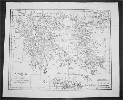
1788 Du Bocage Large Antique Map of Greece, Aegean, Western Turkey & Crete
- Title : La Grece et Ses Isles Pour le Voyage du Jeune Aanacharis Par M Barbier Du Bocage Aout 1788
- Date : 1788
- Condition: (A+) Fine Condition
- Ref: 16471
- Size: 19 1/4in x 16in (490mm x 410mm)
Description:
This fine large original antique map of Greece, The Aegean Islands and the West Coast of Turkey & Crete illustrating the Voyages of the Anacharsis the Younger was engraved in 1788 - dated - and was published by Jean Denis Barbie du Bocage in his Voyage Anacharsis (The Travels of Anacharsis the Younger in Greece) published between 1781 - 1788.
Voyage Anacharsis is an illustrative account of the travels of Anacharsis the Younger in Greece, during the middle of the fourth century before the Christian era.
Jean Denis Barbie du Bocage: (1760-1825) was a French geographer and cosmographer who studied under D' Anville and became one of the founders of the Geography Society of Paris. (Ref: Tooley; M&B)
General Description:
Paper thickness and quality: - Heavy & stable
Paper color: - White
Age of map color: -
Colors used: - General color appearance: -
Paper size: - 19 1/4in x 16in (490mm x 410mm)
Plate size: - 18 1/2in x 14 1/2in (470mm x 370mm)
Margins: - Min 1in (25mm)
Imperfections:
Margins: - None
Plate area: - Folds as issued
Verso: - None
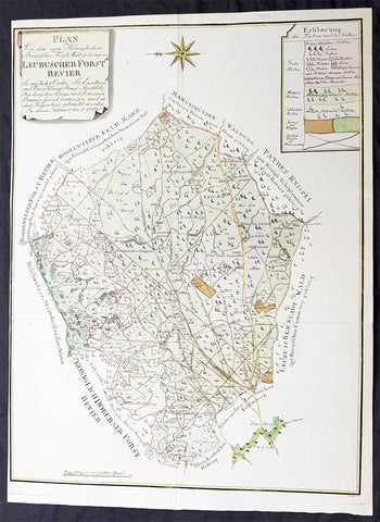
1782 G F Frentzel Large Rare Antique Map of Lubsza Forest Brzeg, Opole SW Poland
- Title : Plan Von Dem zum Koniglichen Briegischen Forfst Amt gehorigen Leubuscher Forst RevierSo Auf hoher Ordre Sr Excellence und Einer Konig Prussia Hochlob Breslauischen Krieges und Domainen Cammer special vermessen und in diese Proportion gebracht worden In denen Jahren 1782 et 1783
- Ref #: 93489
- Size: 21in x 16in (530mm x 415mm)
- Date : 1782-83
- Condition: (A+) Fine Condition
Description:
This incredibly rare detailed original hand coloured copper plate engraved antique map, a survey of the forest near Lubsza in the county of Brzeg in the Opole Province in SW Poland between 1782 & 1783 was engraved by the Leipzig engraver Georg Friedrich Jonas Frentzel.
General Definitions:
Paper thickness and quality: - Heavy and stable
Paper color : - off white
Age of map color: - Original
Colors used: - Green, yellow, brown, pink
General color appearance: - Authentic
Paper size: - 21in x 16in (530mm x 415mm)
Plate size: - 21in x 16in (530mm x 415mm)
Margins: - Min 1/8in (2mm)
Imperfections:
Margins: - Left margin cropped close to border
Plate area: - None
Verso: - None
Background:
Lubsza is a village in Brzeg, Opole Voivodeship, in south-western Poland. It is the seat of the gmina (administrative district) called Gmina Lubsza. It lies approximately 7 kilometres north-east of Brzeg and 41 km north-west of the regional capital Opole. Before 1945 the area was part of Germany
Frentzel, Georg Friedrich Jonas 1754 - 1799
Frentzel was a master-engraver from Leipzig in Germany, specialising in copper engraving. His work was known for its critical level of detail, cumulating in one of the finest revolutionary maps of Boston in 1776 Carte von dem Hafen und der Stadt Boston
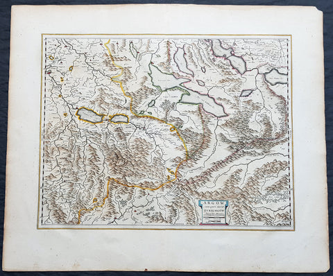
1659 Joan Blaeu Antique Map of The Cantons of Aargau & Zurich, Switzerland
- Title : Argow cum Parte Merid. Zurchgow
- Ref #: 30282
- Size: 24in x 21in (610mm x 535mm)
- Date : 1659
- Condition: (A+) Fine Condition
Description:
This beautifully hand coloured original antique map of the Cantons of Zurich & Aargau in North West Switzerland was published in the 1659 Spanish edition of Joan Blaeus Atlas Novusafter Gerard Mercator.
General Definitions:
Paper thickness and quality: - Heavy and stable
Paper color : - off white
Age of map color: - Original
Colors used: - Blue, pink, red, green, yellow
General color appearance: - Authentic
Paper size: - 24in x 21in (610mm x 535mm)
Plate size: - 21in x 16 1/2in (535mm x 420mm)
Margins: - Min 1in (25mm)
Imperfections:
Margins: - None
Plate area: - None
Verso: - None
Background:
The 26 cantons of Switzerland are the member states of the Swiss Confederation. The nucleus of the Swiss Confederacy in the form of the first three confederate allies used to be referred to as the Waldstätte. Two further major steps in the development of the Swiss cantonal system are referred to by the terms Acht Orte (Eight Cantons; between 1353 and 1481) and Dreizehn Orte (Thirteen Cantons,during 1513–1798); they were important intermediate periods of the Ancient Swiss Confederacy.
Each canton, formerly also Ort (from before 1450), or Stand (estate, from c. 1550), was a fully sovereign state with its own border controls, army, and currency from at least the Treaty of Westphalia (1648) until the establishment of the Swiss federal state in 1848; with a brief period of centralized government during the Helvetic Republic (1798–1803). With the Napoleonic period of the Helvetic Republic the term Kanton was also fully established in German-speaking region.
From 1833, there were 25 cantons, increasing to 26 after the secession of the canton of Jura from Bern in 1979.
The canton of Aargau is one of the more northerly cantons of Switzerland. It is situated by the lower course of the Aare, which is why the canton is called Aar-gau (meaning Aare province). It is one of the most densely populated regions of Switzerland.
The canton of Zürich is a Swiss canton in the northeastern part of the country. It is the most populated canton in the country. Its capital is the city of Zürich. The official language is German. The local Swiss German dialect, called Züritüütsch, is commonly spoken. In English the name of the canton and its capital is often written without an umlaut.
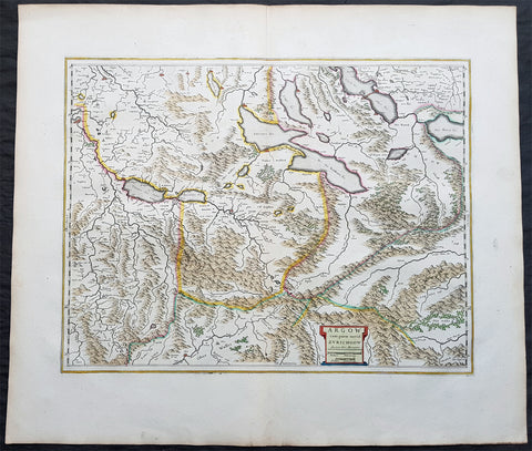
1650 Joan Blaeu Antique Map of The Cantons of Aargau & Zurich, Switzerland
- Title : Argow cum Parte Merid. Zurchgow
- Ref #: 40331
- Size: 24in x 21in (610mm x 535mm)
- Date : 1650
- Condition: (A+) Fine Condition
Description:
This beautifully hand coloured original antique map of the Cantons of Zurich & Aargau in North West Switzerland was published in the 1650 Dutch edition of Joan Blaeus Atlas Novusafter Gerard Mercator.
General Definitions:
Paper thickness and quality: - Heavy and stable
Paper color : - off white
Age of map color: - Original
Colors used: - Blue, pink, red, green, yellow
General color appearance: - Authentic
Paper size: - 24in x 21in (610mm x 535mm)
Plate size: - 21in x 16 1/2in (535mm x 420mm)
Margins: - Min 1in (25mm)
Imperfections:
Margins: - None
Plate area: - None
Verso: - None
Background:
The 26 cantons of Switzerland are the member states of the Swiss Confederation. The nucleus of the Swiss Confederacy in the form of the first three confederate allies used to be referred to as the Waldstätte. Two further major steps in the development of the Swiss cantonal system are referred to by the terms Acht Orte (Eight Cantons; between 1353 and 1481) and Dreizehn Orte (Thirteen Cantons,during 1513–1798); they were important intermediate periods of the Ancient Swiss Confederacy.
Each canton, formerly also Ort (from before 1450), or Stand (estate, from c. 1550), was a fully sovereign state with its own border controls, army, and currency from at least the Treaty of Westphalia (1648) until the establishment of the Swiss federal state in 1848; with a brief period of centralized government during the Helvetic Republic (1798–1803). With the Napoleonic period of the Helvetic Republic the term Kanton was also fully established in German-speaking region.
From 1833, there were 25 cantons, increasing to 26 after the secession of the canton of Jura from Bern in 1979.
The canton of Aargau is one of the more northerly cantons of Switzerland. It is situated by the lower course of the Aare, which is why the canton is called Aar-gau (meaning Aare province). It is one of the most densely populated regions of Switzerland.
The canton of Zürich is a Swiss canton in the northeastern part of the country. It is the most populated canton in the country. Its capital is the city of Zürich. The official language is German. The local Swiss German dialect, called Züritüütsch, is commonly spoken. In English the name of the canton and its capital is often written without an umlaut.
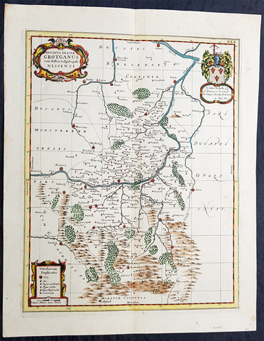
1681 J Jansson & Moses Pitt Rare Antique Map Duchy of Grottkau & Nysa Silesia, Poland
- Title : Ducatus Silesiae Grotganus cum Districtu Episcopali Nissensi
- Ref #: 93485
- Size: 23in x 18in (590mm x 460mm)
- Date : 1681
- Condition: (A+) Fine Condition
Description:
This original rare (not called for in Koeman) hand coloured copper plate engraved antique map of the Duchy of Grottkau and the Diocese of Nysa (Grottkau, Neisse, Brieg and the surrounding area) in the ancient region of Silesia, now in Western Poland by Jan Jansson was published by Moses Pitt in the 1681 edition of Atlas of the World
Moses Pitt 1639–1697 was a bookseller and printer known for the production of his Atlas of the world, a project supported by the Royal Society, and in particular by Christopher Wren. He is also known as the author of The Cry of the Oppressed (1691), an account of the conditions in which imprisoned debtors lived in debtors jails in England.
His work was characterised by its learned content and included authors such as Robert Boyle and Gilbert Burnet. His Atlas was initially intended to be 12 volumes and he continued to undertake other work for the Royal Society. However rising costs, estimated by Pitt at £1000 per volume, contributed to his eventual bankruptcy and only four volumes were ever produced. The second volume had as frontispiece a noted engraved portrait of Queen Catherine of Braganza, by Edward Le Davis.
In Ireland William Molyneux collaborated with Roderic OFlaherty to collect material for the Atlas. While Pitts financial crisis lead to cancellation of the project, much valuable work on early Irish history was collected. Molyneux and OFlaherty struck a friendship and Molyneux assisted when the latters treatise Ogygia was published in London in 1685.
As a result of the Atlas project, Pitt was declared bankrupt. He was taken to the Fleet Prison, and remained there, or in the Kings Bench Prison, for seven years. In 1691, he published The Cry of the Oppressed: Being a True and Tragical Account of the Unparalleld Sufferings of Multitudes of Poor Imprisond Debtors In Most of the Gaols in England, a moving appeal on behalf of prisoners for debt across the country. (Ref: Tooley; M&B)
General Definitions:
Paper thickness and quality: - Heavy and stable
Paper color : - off white
Age of map color: - Original
Colors used: - Blue, pink, red, green, yellow
General color appearance: - Authentic
Paper size: - 23in x 18in (590mm x 460mm)
Plate size: - 20in x 15 3/4in (510mm x 385mm)
Margins: - Min 1in (25mm)
Imperfections:
Margins: - None
Plate area: - None
Verso: - None
Background:
Silesia is a historical region of Central Europe mostly in Poland, with small parts in the Czech Republic and Germany. Its area is approximately 40,000 km2, and the population is estimated at around 8,000,000 inhabitants. Silesia is split into two main sub-regions of Lower Silesia in the west and Upper Silesia in the east. Silesia has a diverse culture, including architecture, costumes, cuisine, traditions, and the Silesian language.
Silesia is along the Oder River, with the Sudeten Mountains extending across the southern border. The region possesses many historical landmarks and UNESCO World Heritage Sites. It is also rich in mineral and natural resources, and includes several important industrial areas. Silesias largest city and historical capital is Wrocław. The biggest metropolitan area is the Upper Silesian metropolitan area, the centre of which is Katowice. Parts of the Czech city of Ostrava and the German city of Görlitz fall within the borders of Silesia.
Silesias borders and national affiliation have changed over time, both when it was a hereditary possession of noble houses and after the rise of modern nation-states. The varied history with changing aristocratic possessions resulted in an abundance of castles, especially in the Jelenia Góra valley. The first known states to hold power in Silesia were probably those of Greater Moravia at the end of the 9th century and Bohemia early in the 10th century. In the 10th century, Silesia was incorporated into the early Polish state, and after its division in the 12th century became a Piast duchy. In the 14th century, it became a constituent part of the Bohemian Crown Lands under the Holy Roman Empire, which passed to the Austrian Habsburg Monarchy in 1526. As a result of the Silesian Wars, the region was annexed by Prussia in 1742.
After World War I, the easternmost part of Upper Silesia was granted to Poland by the Entente Powers after insurrections by Poles and the Upper Silesian plebiscite. The remaining former Austrian parts of Silesia were partitioned to Czechoslovakia, forming part of Czechoslovakias Sudetenland region, and are today part of the Czech Republic. In 1945, after World War II, the bulk of Silesia was transferred to Polish jurisdiction by the Potsdam Agreement between the victorious Allies and became part of Poland, whose Communist government expelled the majority of Silesias previous population. The small Lusatian strip west of the Oder–Neisse line, which had belonged to Silesia since 1815, remained in Germany.
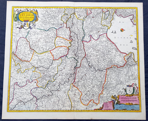
1690 N. Visscher Large Antique Map Northern Holland Guelders & Zutphen Amsterdam
- Title : Ducatus Geldriae et Zutphaniae Comitatus...per Nicolaum Visscher
- Ref #: 93482
- Size: 24in x 20 1/2in (610mm x 520mm)
- Date : 1690
- Condition: (A+) Fine Condition
Description:
This large rare hand coloured original antique map of the Duchy of Guelders and the County of Zutphen was published by Nicholas Visscher II in the 1690 edition of Atlas minor sive totius orbis terrarum contracta delinea ex conatibus Nico. Visscher.
A rare and decorative map of Geldern oriented to the west, covering an area from Amsterdam to the west to Vreden in the east and from Montfoort in the south to Campden in the north.
General Definitions:
Paper thickness and quality: - Heavy and stable
Paper color : - off white
Age of map color: - Original
Colors used: - Yellow, green, blue, pink
General color appearance: - Authentic
Paper size: - 24in x 20 1/2in (610mm x 520mm)
Plate size: - 22 1/2in x 18 1/2in (565mm x 470mm)
Margins: - Min 1/2in (12mm)
Imperfections:
Margins: - None
Plate area: - None
Verso: - None
Background:
Guelders or Gueldres is a historical county, later duchy of the Holy Roman Empire, located in the Low Countries.
The County of Zutphen, located in modern-day Gelderland, a province of the Netherlands, was formed in the eleventh century as a fief of the Bishop of Utrecht. It was ruled by the Counts of Zutphen between 1018 and 1182, and then formed a personal union with Guelders. Later, it became one of the 4 quarters of Guelders. The name Graafschap (county) is still used for the Achterhoek, the region east of Zutphen, and for the football club De Graafschap from this region.
1662 Joan Blaeu Antique Map Duchy of Nysa, Gmina Grodkow Lower Silesia SW Poland
- Title : Ducatus Silesiae Grotganus cum Districtu Episcopali Nissensi
- Ref #: 93428
- Size: 24in x 20in (610mm x 510mm)
- Date : 1662
- Condition: (A) Very Good Condition
Description:
This beautifully hand coloured original copper-plate engraved antique, rare map of Nysa-Grodkow, located at the time of publication in the Duchy of Nysa, in Lower Silesia, today SW Poland, was published in Joan Blaeu greatest publication, the first 1662 French edition of Atlas Major.
As this map was only published over a 10 year period, as most of the plates were destroyed in the disasterous 1672 fire that wiped out the Blaeu publishing house, this map is extremely rare especially with original hand colour, such as this map.
General Definitions:
Paper thickness and quality: - Heavy and stable
Paper color : - off white
Age of map color: - Original
Colors used: - Yellow, green, blue, pink
General color appearance: - Authentic
Paper size: - 24in x 20in (610mm x 510mm)
Plate size: - 21in x 16 1/2in (535mm x 420mm)
Margins: - Min 1in (25mm)
Imperfections:
Margins: - Light soiling
Plate area: - Offsetting
Verso: - Offsetting
Background:
Wolow is a town in Lower Silesian Voivodeship in south-western Poland. It is the seat of Wołów County and Gmina Wołów. It lies approximately 38 kilometres north-west of the regional capital Wrocław.
The area around Wołów has been settled since prehistoric times. It became part of the emerging Polish state in the late 10th century under Mieszko I of Poland. The town was first mentioned in 1157 when a wooden castle founded by Senior Duke of Poland Władysław II the Exile is documented, which developed into a castle complex, which was again mentioned in 1202. Two villages developed near the castle, one of them called Wołowo. Probably in the second half of the 13th century the town was founded near Wołowo and partially on the soil of the second village. Wołów received Magdeburg town rights about 1285 at the time of German Ostsiedlung in the region; a Vogt is mentioned in 1288.
At that time Wołów belonged to the Duchy of Głogów, after 1312 to the Duchy of Oleśnica. With the duchy it came under the suzerainty of Bohemia in 1328. From 1473 dates the oldest known seal of the town, which already shows an ox, as do all later seals. Wołów was ruled by local Polish dukes until 1492, and soon after, in 1495, it came into the possession of the Czech Podiebrad family, then in 1517 it came into the hands the Hungarian magnate Johann Thurzó, before returning to Piast rule in 1523, by passing to the Duchy of Legnica. It remained there until the Piast dukes of Legnica-Brzeg-Wołów died out in 1675. As a result of the Thirty Years War, the towns population fell by half.
The Protestant Reformation was introduced to the town in 1522 by duke Frederick II. After the extinction of the local Piasts the duchy passed to the House of Habsburg, which opposed the Protestant denomination in the town, as part of the Counter-Reformation. In 1682 the towns parish church was closed and given to the Catholics. According to the Treaty of Altranstädt the church however was already returned to the Protestants in 1707 and stayed Protestant until 1945. The small Catholic minority in return received a Josephinian curacy.
In 1742 Wołów was annexed by Prussia. The duchy was divided into two districts and the town became county seat of one of the districts. The structure of the town was, until 1700, defined by craft, especially clothiers. As the seat of a duchy and a district administrative function however became more and more important. The industrialization played only a minor role and mostly affected smaller companies of the timber industry. In 1781 the city suffered a fire.
The town was part of Germany from 1871 to 1945. In January 1945 – just before town was taken by the Red Army – the Wehrmacht evacuated the German population westwards.
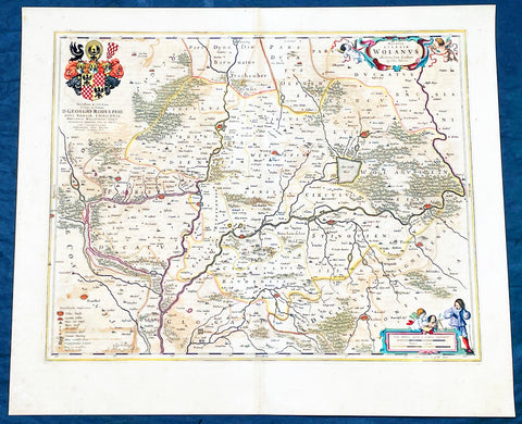
1662 Joan Blaeu Antique Map of Wołow County, Lower Silesia Voivodeship SW Poland
- Title : Ducatus Silesiae Wolanus Authore Jona Sculteto Sprotta Silesio
- Ref #: 93430
- Size: 24in x 20in (610mm x 510mm)
- Date : 1662
- Condition: (A) Very Good Condition
Description:
This beautifully hand coloured original copper-plate engraved antique, rare map of Wolow County, located at the time of publication in the Duchy of Głogow, in Lower Silesia, today SW Poland, was published in Joan Blaeu greatest publication, the first 1662 French edition of Atlas Major,.
As this map was only published over a 10 year period, as most of the plates were destroyed in the disasterous 1672 fire that wiped out the Blaeu publishing house, this map is extremely rare especially with original hand colour, such as this map.
General Definitions:
Paper thickness and quality: - Heavy and stable
Paper color : - off white
Age of map color: - Original
Colors used: - Yellow, green, blue, pink
General color appearance: - Authentic
Paper size: - 24in x 20in (610mm x 510mm)
Plate size: - 21in x 16 1/2in (535mm x 420mm)
Margins: - Min 1in (25mm)
Imperfections:
Margins: - Light soiling
Plate area: - Offsetting
Verso: - Offsetting
Background:
Wolow is a town in Lower Silesian Voivodeship in south-western Poland. It is the seat of Wołów County and Gmina Wołów. It lies approximately 38 kilometres north-west of the regional capital Wrocław.
The area around Wołów has been settled since prehistoric times. It became part of the emerging Polish state in the late 10th century under Mieszko I of Poland. The town was first mentioned in 1157 when a wooden castle founded by Senior Duke of Poland Władysław II the Exile is documented, which developed into a castle complex, which was again mentioned in 1202. Two villages developed near the castle, one of them called Wołowo. Probably in the second half of the 13th century the town was founded near Wołowo and partially on the soil of the second village. Wołów received Magdeburg town rights about 1285 at the time of German Ostsiedlung in the region; a Vogt is mentioned in 1288.
At that time Wołów belonged to the Duchy of Głogów, after 1312 to the Duchy of Oleśnica. With the duchy it came under the suzerainty of Bohemia in 1328. From 1473 dates the oldest known seal of the town, which already shows an ox, as do all later seals. Wołów was ruled by local Polish dukes until 1492, and soon after, in 1495, it came into the possession of the Czech Podiebrad family, then in 1517 it came into the hands the Hungarian magnate Johann Thurzó, before returning to Piast rule in 1523, by passing to the Duchy of Legnica. It remained there until the Piast dukes of Legnica-Brzeg-Wołów died out in 1675. As a result of the Thirty Years War, the towns population fell by half.
The Protestant Reformation was introduced to the town in 1522 by duke Frederick II. After the extinction of the local Piasts the duchy passed to the House of Habsburg, which opposed the Protestant denomination in the town, as part of the Counter-Reformation. In 1682 the towns parish church was closed and given to the Catholics. According to the Treaty of Altranstädt the church however was already returned to the Protestants in 1707 and stayed Protestant until 1945. The small Catholic minority in return received a Josephinian curacy.
In 1742 Wołów was annexed by Prussia. The duchy was divided into two districts and the town became county seat of one of the districts. The structure of the town was, until 1700, defined by craft, especially clothiers. As the seat of a duchy and a district administrative function however became more and more important. The industrialization played only a minor role and mostly affected smaller companies of the timber industry. In 1781 the city suffered a fire.
The town was part of Germany from 1871 to 1945. In January 1945 – just before town was taken by the Red Army – the Wehrmacht evacuated the German population westwards.
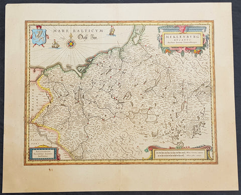
1646 Jan Jansson Antique Map of Mecklenburg NE Germany Rostock, Wizmar, Parchim
- Title : Meklenburg Ducatus
- Ref #: 50185
- Size: 11 1/2in x 8in (290mm x 205mm)
- Date : 1646
- Condition: (A+) Fine Condition
Description:
This beautifully hand coloured original copper-plate engraved antique map of the Mecklenburg, north eastern Germany by Jan Jansson was published in the 1646 Latin edition of Mercators Atlas by Jan Jansson and Henricus Hondius. (Ref: Tooley, Koeman)
General Definitions:
Paper thickness and quality: - Heavy and stable
Paper color : - off white
Age of map color: - Original
Colors used: - Yellow, green, blue, pink
General color appearance: - Authentic
Paper size: - 22in x 18in (560mm x 460mm)
Plate size: - 19in x 14 1/2in (480mm x 370mm)
Margins: - Min 2in (50mm)
Imperfections:
Margins: - None
Plate area: - None
Verso: - None
Background:
Mecklenburg is a historical region in northern Germany comprising the western and larger part of the federal-state Mecklenburg-Vorpommern. The largest cities of the region are Rostock, Schwerin, Neubrandenburg, Wismar and Güstrow.
The name Mecklenburg derives from a castle named Mikilenburg (Old Saxon: big castle, hence its translation into New Latin and Greek: Megalopolis), located between the cities of Schwerin and Wismar. In Slavic language it was known as Veligrad, which also means big castle. It was the ancestral seat of the House of Mecklenburg; for a time the area was divided into Mecklenburg-Schwerin and Mecklenburg-Strelitz among the same dynasty.
Linguistically Mecklenburgers retain and use many features of Low German vocabulary or phonology.
Mecklenburg is the site of many prehistoric dolmen tombs. Its earliest organised inhabitants may have had Celtic origins. By no later than 100 BC the area had been populated by pre-Christian Germanic peoples.
The traditional symbol of Mecklenburg, the grinning steers head (Low German: Ossenkopp, lit.: oxen\'s head, with osse being a synonym for steer and bull in Middle Low German), with an attached hide, and a crown above, may have originated from this period. It represents what early peoples would have worn, i.e. a steers\'s head as a helmet, with the hide hanging down the back to protect the neck from the sun, and overall as a way to instill fear in the enemy.
From the 7th through the 12th centuries, the area of Mecklenburg was taken over by Western Slavic peoples, most notably the Obotrites and other tribes that Frankish sources referred to as Wends. The 11th century founder of the Mecklenburgian dynasty of Dukes and later Grand Dukes, which lasted until 1918, was Nyklot of the Obotrites.
In the late 12th century, Henry the Lion, Duke of the Saxons, conquered the region, subjugated its local lords, and Christianized its people, in a precursor to the Northern Crusades. From 12th to 14th century, large numbers of Germans and Flemings settled the area (Ostsiedlung), importing German law and improved agricultural techniques. The Wends who survived all warfare and devastation of the centuries before, including invasions of and expeditions into Saxony, Denmark and Liutizic areas as well as internal conflicts, were assimilated in the centuries thereafter. However, elements of certain names and words used in Mecklenburg speak to the lingering Slavic influence. An example would be the city of Schwerin, which was originally called Zuarin in Slavic. Another example is the town of Bresegard, the \'gard\' portion of the town name deriving from the Slavic word \'grad\', meaning city or town.
Since the 12th century, the territory remained stable and relatively independent of its neighbours; one of the few German territories for which this is true. During the reformation the Duke in Schwerin would convert to Protestantism and so would follow the Duchy of Mecklenburg.
Like many German territories, Mecklenburg was sometimes partitioned and re-partitioned among different members of the ruling dynasty. In 1621 it was divided into the two duchies of Mecklenburg-Schwerin and Mecklenburg-Güstrow. With the extinction of the Güstrow line in 1701, the Güstrow lands were redivided, part going to the Duke of Mecklenburg-Schwerin, and part going to the new line of Mecklenburg-Strelitz.
In 1815, the two Mecklenburgian duchies were raised to Grand Duchies, the Grand Duchy of Mecklenburg-Schwerin and the Grand Duchy of Mecklenburg-Strelitz, and subsequently existed separately as such in Germany under enlightened but absolute rule (constitutions being granted on the eve of World War I) until the revolution of 1918. Life in Mecklenburg could be quite harsh. Practices such as having to ask for permission from the Grand Duke to get married, or having to apply for permission to emigrate, would linger late into the history of Mecklenburg (i.e. 1918), long after such practices had been abandoned in other German areas. Even as late as the later half of the 19th century the Grand Duke personally owned half of the countryside. The last Duke abdicated in 1918, as monarchies fell throughout Europe. The Duke\'s ruling house reigned in Mecklenburg uninterrupted (except for two years) from its incorporation into the Holy Roman Empire until 1918. From 1918 to 1933, the duchies were free states in the Weimar Republic.
Traditionally Mecklenburg has always been one of the poorer German areas, and later the poorer of the provinces, or Länder, within a unified Germany. The reasons for this may be varied, but one factor stands out: agriculturally the land is poor and can not produce at the same level as other parts of Germany. The two Mecklenburgs made attempts at being independent states after 1918, but eventually this failed as their dependence on the rest of the German lands became apparent.
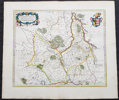
1650 Joan Blaeu Antique Map of Archbishopric of Madenburg Saxony-Anhalt, Germany
- Title : Magdeburgensis Archiepiscopatus
- Ref #: 40335
- Size: 24in x 21in (610mm x 535mm)
- Date : 1650
- Condition: (A+) Fine Condition
Description:
This beautifully hand coloured original copper-plate engraved antique map of the Archbishopric of Madenburg today located in the state of Saxony-Anhalt, Germany, on the Elbe River, was published in the 1650 Dutch edition of Joan Blaeus Atlas Novus.
General Definitions:
Paper thickness and quality: - Heavy and stable
Paper color : - off white
Age of map color: - Original
Colors used: - Blue, pink, red, green, yellow
General color appearance: - Authentic
Paper size: - 24in x 21in (610mm x 535mm)
Plate size: - 21in x 16 1/2in (535mm x 420mm)
Margins: - Min 1in (25mm)
Imperfections:
Margins: - Light age toning
Plate area: - None
Verso: - None
Background:
The Archbishopric of Magdeburg was a Roman Catholic archdiocese (969–1552) and Prince-Archbishopric (1180–1680) of the Holy Roman Empire centered on the city of Magdeburg on the Elbe River.
Planned since 955 and established in 968, the Roman Catholic archdiocese had de facto turned void since 1557, when the last papally confirmed prince-archbishop, the Lutheran Sigismund of Brandenburg came of age and ascended to the see and the Magdeburg cathedral chapter had adopted Lutheranism in 1567, with most parishioners having preceded in their conversion. All his successors were only administrators of the prince-archbishopric and Lutheran too, except of the Catholic layman Leopold William of Austria (1631–1635). In ecclesiastical respect the remaining Catholics and their parishes and abbeys in the former archdiocese were put under supervision of the Archdiocese of Cologne in 1648 and under the jurisdiction of the Apostolic Vicariate of the Northern Missions in 1670.
In political respect the Erzstift, the archiepiscopal and capitular temporalities, had gained imperial immediacy as prince-archbishopric in 1180. Its territory comprised only some parts of the archdiocesan area, such as the city of Magdeburg, the bulk of the Magdeburg Börde, and the Jerichow Land as an integral whole and exclaves comprising about the Saalkreis including Halle upon Saale, Oebisfelde and environs as well as Jüterbog and environs. The prince-archbishopric maintained its statehood as an elective monarchy until 1680. Then Brandenburg-Prussia acquired Magdeburg prince-archbishopric, and after being secularised, transformed it into the Duchy of Magdeburg, a hereditary monarchy in personal union with Brandenburg.
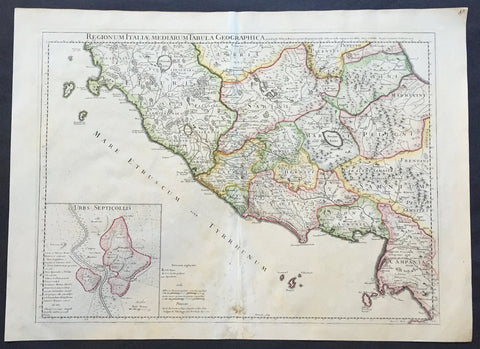
1711 Claude Delisle Large Antique Map of Rome and Regions, Italy
- Title : Regionum Italiae Mediarum Tabula Geographica Par Guill. Delisle.....1711
- Ref #: 31904
- Size: 28in x 21in (660mm x 535mm)
- Date : 1711
- Condition: (A+) Fine Condition
Description:
This large beautifully engraved hand coloured original antique map of Rome and the regions surrounding the ancient capital was engraved in 1711 - the date is engraved at the foot of the map - and was published by Guillaume Delisle in the Atlas Nouveau. (Ref: M&B; Tooley)
Condition Report
Paper thickness and quality: - Very heavy and stable
Paper color: - Off white
Age of map color: - Original
Colors used: - Yellow, green, pink
General color appearance: - Authentic
Paper size: - 28in x 21in (660mm x 535mm)
Plate size: - 24in x 18 1/2in (610mm x 470mm)
Margins: - min. 1in (25mm)
Imperfections:
Margins: - Repair to bottom margin
Plate area: - Light creasing and slight discolouration to bottom centerold
Verso: - None
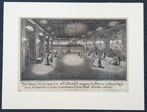
1735 Schubler & Steidlin Antique Baroque Print Musical Ball Regensburg Ger. 1717
- Title : Bal, welche den 26. Sept: 1717 in Sr Durchl: Eminens des Herrn Cardinals residens zu Regensburg, in dem so genamten Lowen-Saal, gehalten worden....NB das Bal Zimmer war mit rohten Tuch belegt
- Ref #: 93443
- Size: 19in x 13 1/2in (490mm x 345mm)
- Date : 1735
- Condition: (A) Very Good Condition
Description:
This large original Baroque copper plate engraved antique print, numbered three of three, of an early 18th century Ball, part of the celebrations at the Royal Court in the Cardinal Castle of Regensburg, on September 26, 1717, by Johann Schubler, was engraved by Johann Matthias Steidlin or Steudlin 1717-1754 and published by the Jeremias Wolff Erben in 1735.
A wonderful piece of Baroque art, engraved and published by some of the foremost art engravers and publishers at the beginning of the 18th century.
Professionally matted and can be easily removed if required.
General Definitions:
Paper thickness and quality: - Heavy and stable
Paper color : - off white
Age of map color: -
Colors used: -
General color appearance: -
Paper size: - 19in x 13 1/2in (490mm x 345mm)
Plate size: - 19in x 13 1/2in (490mm x 345mm)
Margins: - Min 1/2in (12mm)
Imperfections:
Margins: - Small repair bottom right signature
Plate area: - Folds as issued
Verso: - None
Background:
In 1245 Regensburg became a Free Imperial City and was a trade centre before the shifting of trade routes in the late Middle Ages. In 1486, Regensburg became part of the Duchy of Bavaria, but its independence was restored by the Holy Roman Emperor ten years later. In the city took place the Diet of 1541, was adopted the Protestant Reformation in 1542 and its Town Council remained entirely Lutheran. From 1663 to 1806, the city was the permanent seat of the Imperial Diet of the Holy Roman Empire, which became known as the Perpetual Diet of Regensburg. Thus, Regensburg was one of the central towns of the Empire, attracting visitors in large numbers.
A minority of the population remained Roman Catholic, and Roman Catholics were denied civic rights (Bürgerrecht). Although the Imperial city had adopted the Reformation, the town remained the seat of a Roman Catholic bishop and several abbeys. Three of these, St. Emmeram, Niedermünster and Obermünster, were free imperial estates within the Holy Roman Empire, meaning that they were granted a seat and a vote at the Imperial Diet (Reichstag). So there was the unique situation that the town of Regensburg comprised five independent states (in terms of the Holy Roman Empire): the Protestant city itself, the Roman Catholic bishopric, and the three monasteries. In addition, it was seen as the traditional capital of the region Bavaria (not the state), acted as functional co-capital of the Empire (second to the Emperors court at Vienna) due to the presence of the Perpetual Diet, and it was the residence of the Emperors Commissary-Principal to the same diet, who with one very brief exception was a prince himself (for many years the Prince of Thurn and Taxis, still resident in the town).
Schübler, Johann Jacob 1689 - 1741
Schübler was born in Nuremberg as was known as a versatile German baroque master builder , architectural theorist and writer and mathematician.
Schüblers father Johann Jacob was a braid maker and language teacher, and he also had medical knowledge, which he also used for a fee. He came to Nuremberg from Strasbourg and became resident there by marrying Maria Elisabeth Hengel, the daughter of an independent braid maker. The later master builder Johann Jacob Schübler was the fourth of the couples eight children. Through his father and private tutors, he received careful training, mainly in artistic subjects as well as in old and new languages. Architectural painter Johann Andreas Graff gave him his first drawing lessons . In 1698 he began his apprenticeship as a draftsman in the studio of the portraitist, engraver and art dealerJacob von Sandrart (1630-1708), in addition he was taught by Georg Christoph Eimmart (1638-1705), the long-time director of the important Nuremberg Academy of Painters , a representative of the mathematically oriented artists of the time and founder of the observatory at the Nuremberg castle .
At that time, extensive study trips were common for aspiring artists to complete their training. Between 1705 and 1713, Schüblers years of traveling took him through Germany, Denmark and Norway, the Netherlands and France - with a stopover in 1711 with his parents in Nuremberg. The time around 1700 in Europe was particularly intensive secular and church building activity, numerous elaborate, representative buildings. Schüblers travel destinations were primarily places where the current building activity was concentrated. However, Italy was missing from this program. He made longer stays for scholarly studies in Leipzig and Copenhagen .
After his return in 1713, Schübler remained settled in Nuremberg. Prominent colleagues such as Balthasar Neumann (1687–1753) visited him and he corresponded with well-known artists and scientists. He rejected various offers from foreign employers because they did not seem attractive enough to him. In 1717 he received the order for a gate of honor, which was built to celebrate a princely wedding in the main square of the residential city of Sulzbach . Schübler had an expansive triumphal arch with three stacked columns and niches for allegorical figures built, which was generally praised. A permanent position at the court of the Sulzbach Palatinate Countshowever, did not result from this. So he remained the prevented Builder. Great vocations only reached him towards the end of his life. In 1740 the Danish king invited him to Copenhagen, in 1741 negotiations for a move to Berlin followed to the court of the Prussian king Friedrich II. Both offers came too late for Schübler. He died in September 1741 from a clock-like illness.
Schübler only started his own family at an advanced age. In 1727 he married Margareta Maria Hemme, the daughter of a respected art dealer. At around 40, the bride was even a little older than Schübler herself; she died two years after the marriage, the marriage remained childless. In 1733 Schübler had a second marriage to 26-year-old Margaretha Setzmair. She also came from a long-established, wealthy middle-class family. The couple had two daughters, one of whom died very early, and a son who was born several months after Schüblers death.
In 1734 Schübler was accepted as an external member of the Prussian Academy of Sciences in Berlin. The small Schüblerstrasse in Nuremberg reminds him of him.
Schüblers actual lifes work consisted of a large number of writings, the publication of which he began around 1715. With his later works in particular, he pursued the intention of scientifically examining the questions of the building industry based on proportion and perspective, thereby making them teachable and learnable for building theorists and practitioners of his time.
Initially, Schübler published smaller masterpieces that appeared in deliveries of six to twelve engravings and contained hardly any text. In it he showed architectural details (e.g. fireplaces , mansard windows , pulpits, altars, confessionals), furniture (beds, desks, clocks, night chairs) and technical objects such as pumping stations and fountains. He drew the originals himself, often with a light color, but hardly ever took over the transfer to the printing plates, even though he knew this technique. For this, he employed a large number of engravers, among them Johann August Corvinus, Johann Matthias Steidlin, Georg Lichtensteger and his own brother Georg Andreas. The objects depicted often appear grotesquely overloaded with decorative elements such as flower threads, sphinxes and the like, but were also not intended for direct implementation. Rather, the executing tradesmen were able to take very different suggestions from a single template. The templates appeared in the publisher Jeremias Wolff in Augsburg, which is renowned throughout Europe .
Schüblers more scientific and literary works were mostly published by Johann Christoph Weigel in Nuremberg. In 1719/20 Perspectiva Pes Picturae was published in two parts , a large-format work of art intended to provide the basis for architectural painting . 1723/24, again in two parts, came out a textbook on the column orders with practical aids for difficult problems, which was reprinted several times. This was followed by publications on the art of sundial (1726) and on the wood-fired parlor ovens(1728). Schüblers main works then appeared within five years. With them he wanted to provide a new, in-depth representation of the entire architecture, with the main areas of the Architectura Civilis and the Architectura Militaris . From the years 1732-35 are the five illustrated volumes of a Synopsis Architecturae Civilis eclecticae , to which the content of the theoretical work Ars inveniendi from 1734 on civil architecture can be assigned. The two volumes of carpentry (Ars Tignaria) date from 1731 and 1736 . The main works include Perspectiva Geometrica Practica .
Schüblers works were widespread, and individual writings had up to 20 editions. The last known new edition dates from 1786. The popularity of his practically applicable proposals ended with the domination of baroque and rococo in architecture. The new general artist lexicon by art historian Georg Kaspar Nagler (1801–1866) already discusses Schüblers works as examples of the aesthetic aberrations of an era that has been overcome and describes them as senseless outbursts of an unregulated imagination.
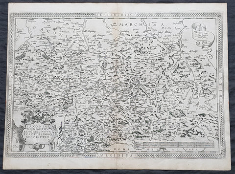
1575 Abraham Ortelius Antique Map Obersachsen, Meissen and Thuringen, Germany
- Title : Saxoniae Misniae, Thuringiae, Nova Exactissimaq Descriptio
- Size: 20 1/2in x 15 1/2in (520mm x 390mm)
- Condition: (A+) Fine Condition
- Date : 1587
- Ref #: 30032
Description:
These original copper-plate engraved antique map of the Obersachsen, Meissen and Thuringen regions of Germany was published in the 1575 French edition of Abraham Ortelius Atlas Theatrum Orbis Terrarum.
General Definitions:
Paper thickness and quality: - Heavy and stable
Paper color : - off white
Age of map color: -
Colors used: -
General color appearance: -
Paper size: - 20 1/2in x 15 1/2in (520mm x 390mm)
Plate size: - 20in x 13 1/2in (510mm x 345mm)
Margins: - Min 1/4in (4mm)
Imperfections:
Margins: - Light soiling
Plate area: - None
Verso: - Soiling
Background:
Ortelius regional map of Germany, showing the area between Berlin and Braunschweig in the north, to Prague in the south and Silesia in the east. With Chemnitz, Dresden, Leipzig, Wittenberg and Erfurt
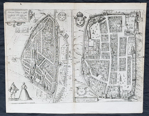
1574 Braun & Hogenberg Antique Birds Eye Views Chartres & Chateaudu Loire France
- Title : Autricum, Prolemeo in Gallia Lugdunensis Urbs; vulgo, cum Villa nouano, Chartres / Chasteaudunum, Comitatus vulgo Dunoys in Gallia Oppidum primorium
- Size: 19in x 15 1/2in (490mm x 390mm)
- Condition: (A+) Fine Condition
- Date : 1574
- Ref #: 30267
Description:
This original copper-plate engarved antique print, a birds eye view of cities of Chartres and Chateaudu , in Loire, France was published by Georg Braun & Frans Hogenberg for the 1574 atlas of town plans Civiates Orbis Terrarumintended as a companion to Abraham Ortelius\'s master Atlas Theatrum Orbis Terrarum published in 1570.
General Definitions:
Paper thickness and quality: - Heavy and stable
Paper color : - off white
Age of map color: -
Colors used: -
General color appearance: -
Paper size: - 19in x 15 1/2in (490mm x 390mm)
Plate size: - 19in x 15 1/2in (490mm x 390mm)
Margins: - Min 1/4in (6mm)
Imperfections:
Margins: - None
Plate area: - None
Verso: - None
Background:
Chartres is a commune and capital of the Eure-et-Loir department in France. It is located about 90 km (56 mi) southwest of Paris.
Chartres was in Gaul one of the principal towns of the Carnutes, a Celtic tribe. In the Gallo-Roman period, it was called Autricum, name derived from the river Autura (Eure), and afterwards civitas Carnutum, city of the Carnutes, from which Chartres got its name. The city was burned by the Normans in 858, and unsuccessfully besieged by them in 911.
During the Middle Ages, it was the most important town of the Beauce. It gave its name to a county which was held by the counts of Blois, and the counts of Champagne, and afterwards by the House of Châtillon, a member of which sold it to the Crown in 1286.
In 1417, during the Hundred Years War, Chartres fell into the hands of the English, from whom it was recovered in 1432.
In 1528, it was raised to the rank of a duchy by Francis I.
In 1568, during the Wars of Religion, Chartres was unsuccessfully besieged by the Huguenot leader, the Prince of Condé. It was finally taken by the royal troops of Henry IV on 19 April 1591. On Sunday, 27 February 1594, the cathedral of Chartres was the site of the coronation of Henry IV after he converted to the Catholic faith, the only king of France whose coronation ceremony was not performed in Reims.
In 1674, Louis XIV raised Chartres from a duchy to a duchy peerage in favor of his nephew, Duke Philippe II of Orléans. The title of Duke of Chartres was hereditary in the House of Orléans, and given to the eldest son of the Duke of Orléans.
In the 1870-1871 Franco-Prussian War, Chartres was seized by the Germans on 2 October 1870, and continued during the rest of the war to be an important centre of operations.
Chateaudun is located about 45 km northwest of Orléans, and about 50 km south-southwest of Chartres. It lies on the river Loir, a tributary of the Sarthe.
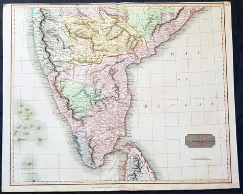
1816 John Thomson Large Antique Map of Southern India & Northern Sri Lanka
- Title : Southern Hindostan....Drawn & Engraved for Thomsons New General Atlas, 1816
- Date : 1816
- Size: 25in x 20 1/2in (635mm x 520mm)
- Condition: (A+) Fine Condition
- Ref: 41004
Description:
This large magnificent original hand coloured copper-plate engraved antique map of South India & northern Sri Lanka by John Thomson was engraved by Samuel Neele in 1816 - dated at the foot of the map - and was published in the 1817 edition of Thomsons New General Atlas
General Definitions:
Paper thickness and quality: - Heavy and stable
Paper color : - off white
Age of map color: - Original
Colors used: - Yellow, green, blue, pink
General color appearance: - Authentic
Paper size: - 25in x 20 1/2in (635mm x 520mm)
Plate size: - 25in x 20 1/2in (635mm x 520mm)
Margins: - Min 1/2in (15mm)
Imperfections:
Margins: - Top margin soiling and cropped to plate-mark
Plate area: - None
Verso: - None
Background:
The cartography of India begins with early charts for navigation and constructional plans for buildings. Indian traditions influenced Tibetan and Islamic traditions, and in turn, were influenced by the British cartographers who solidified modern concepts into India\'s map making
A prominent foreign geographer and cartographer was Hellenistic geographer Ptolemy (90–168) who researched at the library in Alexandria to produce a detailed eight-volume record of world geography. During the Middle Ages, India sees some exploration by Chinese and Muslim geographers, while European maps of India remain very sketchy. A prominent medieval cartographer was Persian geographer Abu Rayhan Biruni (973–1048) who visited India and studied the country\'s geography extensively.
European maps become more accurate with the Age of Exploration and Portuguese India from the 16th century. The first modern maps were produced by Survey of India, established in 1767 by the British East India Company. Survey of India remains in continued existence as the official mapping authority of the Republic of India.
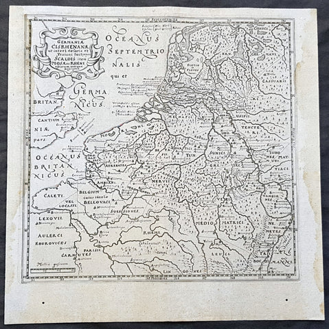
1611 Philipp Cluver Antique Map The Netherlands, Belgium, parts France & Germany
- Title : Germaniae Cisrhenanae ut interl. caesaris et Traiani suit imperii Scaldis item Mosae ac Rheni ostiorum antiqua Descriptio
- Size: 11 1/2in x 11 1/2in (295mm x 295mm)
- Condition: (A+) Fine Condition
- Date : 1611
- Ref #: 23967
Description:
This fine original wood-block engraved antique map of The Netherlands, Belgium, Northern France and parts of Western Germany was published in the 1611 edition of Philip Cluvers first publication Commentarius de tribus Rheni alveis, et ostiis; item. De Quinque populis quondam accolis; scilicet de Toxandris, Batavis, Caninefatibus, Frisiis, ac Marsacis. (Ref: King; Tooley; M&B)
General Definitions:
Paper thickness and quality: - Heavy and stable
Paper color : - off white
Age of map color: -
Colors used: -
General color appearance: -
Paper size: - 11 1/2in x 11 1/2in (295mm x 295mm)
Plate size: - 10in x 10in (255mm x 255mm)
Margins: - Min 1/2in (12mm)
Imperfections:
Margins: - Light age toning to left & right margins
Plate area: - None
Verso: - None
Background:
Clüver was an antiquary, who was given a special appointment at Leiden as geographer and put in charge of the university\'s library, but his lifes project, it developed, was a general study of the geography of Antiquity, based not only on classical literary sources, but — and this was his contribution — supplemented by wide travels and local inspections. He became virtually the founder of historical geography.
Clüvers first work, in 1611, concerning the lower reaches of the Rhine and its tribal inhabitants in Roman times (Commentarius de tribus Rheni alveis, et ostiis; item. De Quinque populis quondam accolis; scilicet de Toxandris, Batavis, Caninefatibus, Frisiis, ac Marsacis) touched a source of national pride among the Seventeen Provinces, for the Dutch were enjoying a twelve years truce in their Eighty Years War of liberation.
Cluver, Philipp 1580 – 1622
Clüver - also Klüwer, Cluwer, or Cluvier, Latinized as Philippus Cluverius and Philippi Cluverii) - was an Early Modern German geographer and historian.
Clüver was born in Danzig (Gdańsk), in Royal Prussia, a province of the Kingdom of Poland. After spending some time at the Polish court of Sigismund III Vasa, he began the study of law at the University of Leiden (Dutch Republic), but soon he turned his attention to history and geography, which were then taught there by Joseph Scaliger.
Clüver received science education from his father, who was Münzmeister at Danzig (coin master), but when Clüver went into different studies, his father stopped supporting his studies. He therefore travelled from Leiden across Hungary to Bohemia, where he did military service for a few years. While in Bohemia, he translated into Latin a defense by Baron Popel Lobkowitz, who was imprisoned. Upon his return to Leiden, he faced sanctions by the imperial (Habsburg) authorities for this, which however he could avoid with the help of his Leiden friends.
Clüver also travelled in England, Scotland, and France. He did all travel on foot, finally returning to Leiden, where (after 1616) he received a regular pension from the university. He died in Leiden.
Clüver was an antiquary, who was given a special appointment at Leiden as geographer and put in charge of the university\\\'s library, but his lifes project, it developed, was a general study of the geography of Antiquity, based not only on classical literary sources, but — and this was his contribution — supplemented by wide travels and local inspections. He became virtually the founder of historical geography.
Clüver\\\'s first work, in 1611, concerning the lower reaches of the Rhine and its tribal inhabitants in Roman times (Commentarius de tribus Rheni alveis, et ostiis; item. De Quinque populis quondam accolis; scilicet de Toxandris, Batavis, Caninefatibus, Frisiis, ac Marsacis) touched a source of national pride among the Seventeen Provinces, for the Dutch were enjoying a twelve years\\\' truce in their Eighty Years War of liberation.
Clüvers Germaniae antiquae libri tres (Leiden, 1616) depends on Tacitus and other Latin authors. A volume on the antiquities of Sicily, with notes on Sardinia and Corsica (Sicilia Antiqua cum minoribus insulis ei adjacentibus item Sardinia et Corsica), published at Leiden by Louis Elsevier in 1619, is a useful source, with many reference from writers of Antiquity and maps that are often detached and sold to map collectors. His Introductio in universam geographiam, totally 6 parts, (published posthumously from 1624) was the first comprehensive modern geography, and became a standard geographical textbook.
Clüver was also a prolific a writer on mathematical and theological subjects. He is remembered by collectors and historians of cartography for his edition of Ptolemys Geographia (based on Mercators edition of 1578) and for miniature atlases that were reprinted for most of the 17th century. Many of his maps were etched for him by Petrus Bertius.
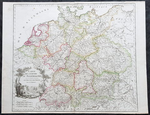
1757 Robert De Vaugondy Large Antique Map of the German States, Bohemia, Austria
- Title : Carte De L Empire D Allemagne..Les Routes Des Postes
- Size: 26in x 19 1/2in (660mm x 495mm)
- Condition: (A+) Fine Condition
- Date : 1757
- Ref #: 41567
Description:
This large magnificent hand coloured original copper-plate engraved antique map of various individual states of Germany including Austria, Bohemia, Switzerland & The Netherlands by Robert De Vaugondy was published in the 1757 edition of De Vaugondys famous The Atlas Universel
General Definitions:
Paper thickness and quality: - Heavy and stable
Paper color : - off white
Age of map color: - Original & later
Colors used: - Blue, pink, red, green, yellow
General color appearance: - Authentic
Paper size: - 26in x 19 1/2in (660mm x 495mm)
Plate size: - 22 1/2in x 19 1/2in (570mm x 495mm)
Margins: - Min 1/4in (5mm)
Imperfections:
Margins: - None
Plate area: - None
Verso: - None
Background:
In the 18th century, the Holy Roman Empire consisted of approximately 1,800 territories. The elaborate legal system initiated by a series of Imperial Reforms (approximately 1450–1555) created the Imperial Estates and provided for considerable local autonomy among ecclesiastical, secular, and hereditary states, reflected in Imperial Diet. The House of Habsburg held the imperial crown from 1438 until the death of Charles VI in 1740. Having no male heirs, he had convinced the Electors to retain Habsburg hegemony in the office of the emperor by agreeing to the Pragmatic Sanction. This was finally settled through the War of Austrian Succession; in the Treaty of Aix-la-Chapelle, Charles VI\'s daughter Maria Theresa ruled the Empire as Empress Consort when her husband, Francis I, became Holy Roman Emperor. From 1740, the dualism between the Austrian Habsburg Monarchy and the Kingdom of Prussia dominated the German history.
In 1772, then again in 1793 and 1795, the two dominant German states of Prussia and Austria, along with the Russian Empire, agreed to the Partitions of Poland; dividing among themselves the lands of the Polish–Lithuanian Commonwealth. As a result of the partitions, millions of Polish speaking inhabitants fell under the rule of the two German monarchies. However, the annexed territories though incorporated into the Kingdom of Prussia and the Habsburg Realm, were not legally considered as a part of the Holy Roman Empire. During the period of the French Revolutionary Wars, along with the arrival of the Napoleonic era and the subsequent final meeting of the Imperial Diet, most of the secular Free Imperial Cities were annexed by dynastic territories; the ecclesiastical territories were secularised and annexed. In 1806 the Imperium was dissolved; many German states, particularly the Rhineland states, fell under the influence of France. Until 1815, France, Russia, Prussia and the Habsburgs (Austria) competed for hegemony in the German states during the Napoleonic Wars
1754 Bellin & Delisle Original Antique Map of Siberia, Russia - after Delisle & Kirilov
- Title : Carte De La Siberie...S Bellin
- Date : 1755
- Ref # : 25538
- Size : 18 3/4in x 14in (480mm x 360mm)
- Condition: (A+) Fine Condition
Description:
This fine large, original copper-plate engraved antique map of Siberia, Eastern Russia by Jacques Nicolas Bellin in 1754 - after Joseph Nicolas Delisle - was published in Antoine François Prevosts 15 volumes of Histoire Generale des Voyages written by Prevost & other authors between 1746-1790.
This detailed map of Siberia, extends from the White & Caspian Seas in the west to Irkuckoi Province, Jakutky on the Lena River and regions just to the east. Centered on the Jenisi River.
The map also notes the trip taken by JN Delisle from Moscow to Beryozovo, in the Khanty-Mansi Autonomous Okrug region to observe the transit of Venus in 1740.
This map by Bellin was taken from JN Delsile, brother of Guillaume Delisle, responsible along with Russian Ivan Kirilov in surveying & publishing the first complete atlas of Russia, Atlas Russicus in 1745.
Jacques Nicolas Delisle was invited by Peter the Great to survey the vast empire of Imperial Russia. Initially accompanied by his step-brother Louis, in 1726 the two Parisians journeyed to Russia (now under the reign of Catherine I) to start their surveys.
At first, Delisle also worked with Ivan Kirilov, with whom he co-founded the St Petersburg Academy of Sciences. However, the two men did not always see eye to eye, and Kirilov went on to produce an incomplete atlas which was published in 1734, before the French team had finished their surveys. Kirilov died in 1737, eight years before the eventual publication of Delisle\'s atlas.
The Atlas Russicus is effectively in two parts: the first covering European Russia in 13 numbered maps (scale 1; 1.527.000), the second covering Siberia in six maps. scale (1: 3.360.000). On map 19 Ostium fluvii Amur the extreme point of Alaska and the Aleutian islands.
It is scarcely necessary to look at a map of Russia - with which we must include Siberia - to visualize the daunting task facing Russian map makers. Indeed, considering the vastness of their territory and the lack of skilled cartographers, it is surprising that relatively good maps were available for engraving and printing in most of the well known sixteenth and seventeenth century atlases. Generally, maps of that time were based on material brought back from Moscow by visitors from the West.
General Definitions:
Paper thickness and quality: - Heavy and stable
Paper color : - off white
Age of map color: - Early
Colors used: - Green, Yellow,
General color appearance: - Authentic
Paper size: - 18 3/4in x 14in (480mm x 360mm)
Plate size: - 18 1/2in x 11 3/4in (470mm x 300mm)
Margins: - Min 1/2in (6mm)
Imperfections:
Margins: - None
Plate area: - Folds as issued
Verso: - None
Background:
One of Antoine Francois Prevosts monumental undertakings was his history of exploration & discovery in 15 volumes titledHistoire Générale des Voyages written between 1746-1759 and was extended to 20 volumes after his death by various authors.
The 20 volumes cover the early explorations & discoveries on 3 continents: Africa (v. 1-5), Asia (v. 5-11), and America (v. 12-15) with material on the finding of the French, English, Dutch, and Portugese.
A number of notable cartographers and engravers contributed to the copper plate maps and views to the 20 volumes including Nicolas Bellin, Jan Schley, Chedel, Franc Aveline, Fessard, and many others.
The African volumes cover primarily coastal countries of West, Southern, and Eastern Africa, plus the Congo, Madagascar, Arabia and the Persian Gulf areas.
The Asian volumes cover China, Korea, Tibet, Japan, Philippines, and countries bordering the Indian Ocean.
Volume 11 includes Australia and Antarctica.
Volumes 12-15 cover voyages and discoveries in America, including the East Indies, South, Central and North America.
Volumes 16-20 include supplement volumes & tables along with continuation of voyages and discoveries in Russia, Northern Europe, America, Asia & Australia.
1764 J B D Anville Large Original Antique Map of Italy inset plan of Rome
- Title : Tabula Italiae Antiqua Geographica...MDCCLXIV
- Date : 1764
- Size: 29in x 21in (740mm x 535mm)
- Ref #: 92297
- Condition: (A+) Fine Condition
Description:
This large finely engraved and highly detailed original antique map of Italy by Jean Baptiste Bourguignon D\'Anville was engraved in 1764 - dated in the tile cartouche - and was published in Jean-Baptiste Bourguinon D\'Anville\'s large elephant folio atlas Atlas Generale.
General Definitions:
Paper thickness and quality: - Heavy and stable
Paper color : - off white
Age of map color: - Original
Colors used: - Yellow, green, pink, blue
General color appearance: - Authentic
Paper size: - 29in x 21in (740mm x 535mm)
Plate size: - 25in x 20in (635mm x 510mm)
Margins: - Min 1/2in (12mm)
Imperfections:
Margins: - Age toning along centerfold
Plate area: - Age toning along centerfold
Verso: - Age toning along centerfold
Background:
Since classical times, ancient Phoenicians, Carthaginians and Greeks established settlements in the south of Italy, with Etruscans and Celts inhabiting the centre and the north of Italy respectively and various ancient Italian tribes and Italic peoples dispersed throughout the Italian Peninsula and insular Italy. The Italic tribe known as the Latins formed the Roman Kingdom, which eventually became a republic that conquered and assimilated other nearby civilisations. Ultimately the Roman Empire emerged as the dominant power in the Mediterranean basin, conquering much of the ancient world and becoming the leading cultural, political and religious centre of Western civilisation. The legacy of the Roman Empire is widespread and can be observed in the global distribution of civilian law, republican governments, Christianity and the Latin script.
During the Early Middle Ages Italy suffered sociopolitical collapse amid calamitous barbarian invasions, but by the 11th century, numerous rival city-states and maritime republics, mainly in the northern and central regions of Italy, rose to great prosperity through shipping, commerce and banking, laying down the groundwork for modern capitalism.These mostly independent statelets, acting as Europe\'s main spice trade hubs with Asia and the Near East, often enjoyed a greater degree of democracy and wealth in comparison to the larger feudal monarchies that were consolidating throughout Europe at the time, though much of central Italy remained under the control of the theocratic Papal States, while Southern Italy remained largely feudal until the 19th century, partially as a result of a succession of Byzantine, Arab, Norman and Spanish conquests of the region.
The Renaissance began in Italy and spread to the rest of Europe, bringing a renewed interest in humanism, science, exploration and art. Italian culture flourished at this time, producing famous scholars, artists and polymaths such as Leonardo da Vinci, Galileo, Michelangelo and Machiavelli. Italian explorers such as Marco Polo, Christopher Columbus, Amerigo Vespucci and Giovanni da Verrazzano discovered new routes to the Far East and the New World, helping to usher in the European Age of Discovery. Nevertheless, Italy\'s commercial and political power significantly waned with the opening of the Atlantic trade route and the route to the Indian Ocean via the Cape of Good Hope, both of which bypassed the Mediterranean. Furthermore, the Italian city-states constantly engaged one another in bloody warfare, culminating in the Italian Wars of the 15th and 16th centuries that left them exhausted, with no one emerging as a dominant power. The weakened Italian sovereigns soon fell victim to conquest by European powers such as France, Spain and Austria.
1638 Jan Jansson Antique Map of The Picardy Region of Northern France - Calais
- Title : Picardia Vera Et Inferior
- Ref #: 50241
- Size: 22 1/2in x 19 1/2in (570mm x 495mm)
- Date : 1638
- Condition: (A+) Fine Condition
Description:
This beautifully hand coloured original copper-plate engraved antique map of The Picardy Region of Northern France - centering on the city of Cambray, NW to Calais, South to Soissons and east to Charleville - was published in the 1638 Latin edition of Mercators Atlas by Jan Jansson and Henricus Hondius.
General Definitions:
Paper thickness and quality: - Heavy and stable
Paper color : - off white
Age of map color: - Original
Colors used: - Yellow, green, blue, pink
General color appearance: - Authentic
Paper size: - 22 1/2in x 19 1/2in (570mm x 495mm)
Plate size: - 21 1/2in x 15 3/4in (545mm x 400mm)
Margins: - Min 1/2in (15mm)
Imperfections:
Margins: - None
Plate area: - None
Verso: - None
Background:
Picardy is a historical territory and a former administrative region of Northern France and now part of the new region Nord-Pas-de-Calais-Picardie.
From the 5th century the area was part of the Frankish Empire, and in the feudal period it encompassed the six countships of Boulogne, Montreuil, Ponthieu, Amiénois,Vermandois, and Laonnois. According to the 843 Treaty of Verdun the region became part of West Francia, the later Kingdom of France.
The name Picardy (which may have referred to a Frankish tribe of picards or pike-bearers) was not used until the 12th or 13th century. During this time, the name applied to all lands where the Picard language was spoken, which included all the territories from Paris to the Netherlands. In the Latin Quarter of Paris, people identified a Picard Nation (Nation Picarde) of students at Sorbonne University, most of whom actually came from Flanders. During the Hundred Years\' War, Picardy was the centre of the Jacquerie peasant revolt in 1358.
From 1419 onwards, the Picardy counties (Boulogne, Ponthieu, Amiens, Vermandois) were gradually acquired by the Burgundian duke Philip the Good, confirmed by King Charles VII of France at the 1435 Congress of Arras. In 1477, King Louis XI of France led an army and occupied key towns in Picardy. By the end of 1477, Louis would control all of Picardy and most of Artois.
In the 16th century, the government (military region) of Picardy was created. This became a new administrative region of France, separate from what was historically defined as Picardy. The new Picardy included the Somme département, the northern half of the Aisne département, and a small fringe in the north of the Oise département.
In 1557, Picardy was invaded by Hapbsburg forces under the command of Emmanuel Philibert, Duke of Savoy. After a seventeen-day siege, St. Quentin would be ransacked while Noyon would be burned by the Habsburg army.
In the 17th century, an infectious disease similar to English sweat originated from the region and spread across France. It was called Suette des picards or Picardy sweat.
Sugar beet was introduced by Napoleon I during the Napoleonic Wars in the 19th century, in order to counter the United Kingdom, which had seized the sugar islands possessed by France in the Caribbean. The sugar industry has continued to play a prominent role in the economy of the region.
One of the most significant historical events to occur in Picardy was the series of battles fought along the Somme during World War I. From September 1914 to August 1918, four major battles, including the Battle of the Somme, were fought by British, French, and German forces in the fields of Northern Picardy. (Ref: Koeman; M&B; Tooley)
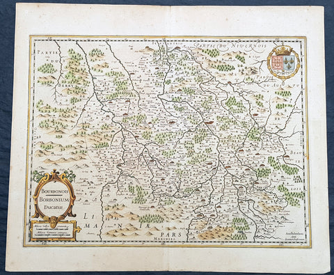
1629 Jan Jansson Antique Map of The Bourbon or Bourbonnais Region Central France
- Title : Boubonoius; Borbonium Ducatus
- Ref #: 50238
- Size: 21 1/2in x 17 1/2in (490mm x 340mm)
- Date : 1629
- Condition: (A+) Fine Condition
Description:
This beautifully hand coloured original copper-plate engraved antique map of The Bourbon or Bourbonnais Region of central France was published in the rare 1629 Latin edition of Mercators Atlas by Jan Jansson and Henricus Hondius.
General Definitions:
Paper thickness and quality: - Heavy and stable
Paper color : - off white
Age of map color: - Original
Colors used: - Yellow, green, blue, pink
General color appearance: - Authentic
Paper size: - 21 1/2in x 17 1/2in (490mm x 340mm)
Plate size: - 20in x 15in (510mm x 380mm)
Margins: - Min 1in (25mm)
Imperfections:
Margins: - Uniform age toning
Plate area: - Uniform age toning
Verso: - Uniform age toning
Background:
Bourbonnais was a historic province in the centre of France that corresponded to the modern département of Allier, along with part of the département of Cher. Its capital was Moulins.
The title of the ruler of Bourbonnais between 913 and 1327, was Sire de Bourbon (or Seigneur de Bourbon). The first lord of Bourbonnais known by name was Adhémar (or Aymon I of Bourbon). Aymon\'s father was Aymar (894-953), sire of Souvigny, his only son with Ermengarde.Aymar lived during the reign of Charles the Simple who, in 913, gave him fiefs on the Allier River in which would become Bourbonnais. He acquired the castle of Bourbon (today Bourbon-l\'Archambault). Almost all early lords took the name d\'Archambaud, after the palace, but later the family became known as the \"House of Bourbon\".
The first House of Bourbon ended in 1196, with the death of Archambault VII, who had only one heir, Mathilde of Bourbon. She married Guy II of Dampierre, who added Montlucon to the possessions of the lords of Bourbon. The second house of Bourbon started in 1218, with Archambault VIII, son of Guy II and Mahaut, and brother of William II of Dampierre. He was followed by his son Archambaut IX, who died in Cyprus in 1249, during a crusade. The House of Burgundy then acquired Bourbonnais.
In 1272, Beatrice of Burgundy (1258-1310), Lady of Bourbon, married Robert de France (1256-1318), Count of Clermont, son of king Louis IX (Saint-Louis). Thus began the long-lasting House of Bourbon, which would provide the kings of France from Henry IV to Louis-Phillipe in 1848, when France abolished its monarchy.
The Bourbons had concluded an alliance with the royal power. They put their forces at the service of the king, thus benefitting from the geographic position of Bourbonnais, located between the royal fidemesne and the duchies of Aquitaine and Auvergne. This alliance, as well as the marriage of Béatrix de Bourgogne and Robert de France, aided the rise and prosperity of the province. In 1327, King Charles (le Bel) elevated Boubonnais to the status of a duchy. (Ref: Koeman; M&B; Tooley)
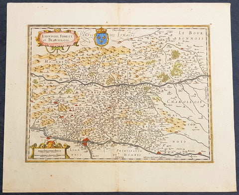
1619 Jan Jansson Antique Map Loire & Rhone Rivers, Auvergne-Rhône-Alpes, France
- Title : Lionnois, Forest et Beaviolois
- Ref #: 50247
- Size: 24in x 20in (610mm x 510mm)
- Date : 1619
- Condition: (A+) Fine Condition
Description:
This beautifully hand coloured original copper-plate engraved antique map of The Auvergne-Rhône-Alpes region of France - centering on the Loire & Rhone Rivers and the cities of Lyon, Vienne & Macon - by Jan Jansson - was published in the 1619 edition of Mercators Atlas by Jan Jansson and Henricus Hondius.
General Definitions:
Paper thickness and quality: - Heavy and stable
Paper color : - off white
Age of map color: - Original
Colors used: - Yellow, green, blue, pink
General color appearance: - Authentic
Paper size: - 24in x 20in (610mm x 500mm)
Plate size: - 20in x 15in (535mm x 380mm)
Margins: - Min 1in (25mm)
Imperfections:
Margins: - None
Plate area: - None
Verso: - None
Background:
Lyon is the third-largest city and second-largest urban area of France. It is located in the country\'s east-central part at the confluence of the rivers Rhône and Saône.
Fernand Braudel remarked, Historians of Lyon are not sufficiently aware of the bi-polarity between Paris and Lyon, which is a constant structure in French development...from the late Middle Ages to the Industrial Revolution. In the late 15th century, the fairs introduced by Italian merchants made Lyon the economic counting house of France. Even the Bourse (treasury), built in 1749, resembled a public bazaar where accounts were settled in the open air. When international banking moved to Genoa, then Amsterdam, Lyon remained the banking centre of France.
During the Renaissance, the cities development was driven by the silk trade, which strengthened its ties to Italy. Italian influence on Lyons architecture is still visible among historic buildings. In the later 1400s and 1500s Lyon was also a key centre of literary activity and book publishing, both of French writers (such as Maurice Scève, Antoine Heroet, and Louise Labé) and of Italians in exile (such as Luigi Alamanni and Gian Giorgio Trissino).
In 1572, Lyon was a scene of mass violence by Catholics against Protestant Huguenots in the St. Bartholomew\'s Day Massacre. Two centuries later, Lyon was again convulsed by violence when, during the French Revolution, the citizenry rose up against the National Convention and supported the Girondins. The city was besieged by Revolutionary armies for over two months before surrendering in October 1793. Many buildings were destroyed, especially around the Place Bellecour, while Jean-Marie Collot d\'Herbois and Joseph Fouché administered the execution of more than 2,000 people. The Convention ordered that its name be changed to Liberated City and a plaque was erected that proclaimed Lyons made war on Liberty; Lyons no longer exists. A decade later, Napoleon ordered the reconstruction of all the buildings demolished during this period.
The Convention was not the only target within Lyon during the 1789-1799 French Revolution. After the National Convention faded into history, the French Directory appeared and days after the September 4, 1797, Coup of 18 Fructidor, a Directory\'s commissioner was assassinated in Lyon.
The city became an important industrial town during the 19th century. In 1831 and 1834, the canuts (silk workers) of Lyon staged two major uprisings for better working conditions and pay. In 1862, the first of Lyon\'s extensive network of funicular railways began operation.
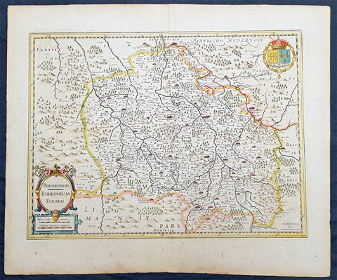
1636 Jan Jansson Antique Map of The Bourbon or Bourbonnais Region Central France
- Title : Boubonoius; Borbonium Ducatus
- Ref #: 41641
- Size: 21 1/2in x 17 1/2in (490mm x 340mm)
- Date : 1636
- Condition: (A) Very Good Condition
Description:
This beautifully hand coloured original copper-plate engraved antique map of The Bourbon or Bourbonnais Region of central France was published in the rare 1636 English edition of Mercators Atlas by Jan Jansson and Henricus Hondius.
There was only one English edition of Mercators Atlas published in 1636 by Jansson & Hondius. These maps - with English text on the verso - are now understandably scarce.
The text running for two pages on the back of the map generally describes the region or country name, history (as it was), temperature, seasons, soil and agricultural productivity. Also described is the topography, wildlife, local inhabitants their culture and religion, as well as a description of major European and local towns and cities. This text makes extremely enjoyable reading and a very good insight not only into the area described but the general European attitudes towards alien countries and cultures.
General Definitions:
Paper thickness and quality: - Heavy and stable
Paper color : - off white
Age of map color: - Original
Colors used: - Yellow, green, blue, pink
General color appearance: - Authentic
Paper size: - 21 1/2in x 17 1/2in (490mm x 340mm)
Plate size: - 20in x 15in (510mm x 380mm)
Margins: - Min 1in (25mm)
Imperfections:
Margins: - Uniform age toning
Plate area: - Uniform age toning
Verso: - Uniform age toning
Background:
Bourbonnais was a historic province in the centre of France that corresponded to the modern département of Allier, along with part of the département of Cher. Its capital was Moulins.
The title of the ruler of Bourbonnais between 913 and 1327, was Sire de Bourbon (or Seigneur de Bourbon). The first lord of Bourbonnais known by name was Adhémar (or Aymon I of Bourbon). Aymon\'s father was Aymar (894-953), sire of Souvigny, his only son with Ermengarde.Aymar lived during the reign of Charles the Simple who, in 913, gave him fiefs on the Allier River in which would become Bourbonnais. He acquired the castle of Bourbon (today Bourbon-l\'Archambault). Almost all early lords took the name d\'Archambaud, after the palace, but later the family became known as the \"House of Bourbon\".
The first House of Bourbon ended in 1196, with the death of Archambault VII, who had only one heir, Mathilde of Bourbon. She married Guy II of Dampierre, who added Montlucon to the possessions of the lords of Bourbon. The second house of Bourbon started in 1218, with Archambault VIII, son of Guy II and Mahaut, and brother of William II of Dampierre. He was followed by his son Archambaut IX, who died in Cyprus in 1249, during a crusade. The House of Burgundy then acquired Bourbonnais.
In 1272, Beatrice of Burgundy (1258-1310), Lady of Bourbon, married Robert de France (1256-1318), Count of Clermont, son of king Louis IX (Saint-Louis). Thus began the long-lasting House of Bourbon, which would provide the kings of France from Henry IV to Louis-Phillipe in 1848, when France abolished its monarchy.
The Bourbons had concluded an alliance with the royal power. They put their forces at the service of the king, thus benefitting from the geographic position of Bourbonnais, located between the royal fidemesne and the duchies of Aquitaine and Auvergne. This alliance, as well as the marriage of Béatrix de Bourgogne and Robert de France, aided the rise and prosperity of the province. In 1327, King Charles (le Bel) elevated Boubonnais to the status of a duchy. (Ref: Koeman; M&B; Tooley)
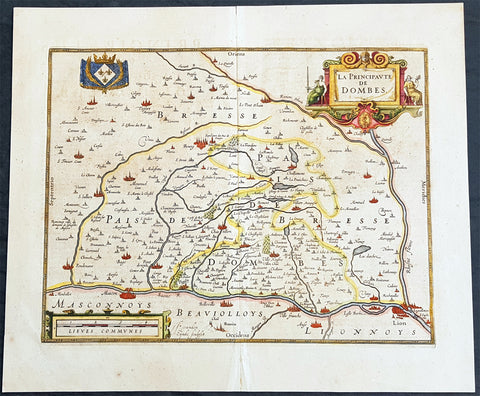
1638 Henricus Hondius Antique Map of the Principality of Dombes, Ain, SE France
- Title : La Principaute De Dombes
- Ref #: 50239
- Size: 22in x 19in (560mm x 480mm)
- Date : 1638
- Condition: (A+) Fine Condition
Description:
This beautifully hand coloured original copper-plate engraved antique map of the Principality of Dombes of south-eastern France - now a part of the Ain Dept. centering on the cities of Mascon & Lyon on the Saone and Rhone Rivers - was published in the 1638 Latin edition of Mercators Atlas published by Henricus Hondius.& Jan Jansson.
General Definitions:
Paper thickness and quality: - Heavy and stable
Paper color : - off white
Age of map color: - Original
Colors used: - Yellow, green, blue, pink
General color appearance: - Authentic
Paper size: - 22in x 19in (560mm x 480mm)
Plate size: - 18in x 14in (460mm x 360mm)
Margins: - Min 1in (25mm)
Imperfections:
Margins: - None
Plate area: - None
Verso: - Age toning
Background:
The Dombes is an area in south-eastern France, once an independent municipality, formerly part of the province of Burgundy, and now a district comprised in the department of Ain, and bounded on the west by the Saône River, by the Rhône, on the east by the Ain and on the north by the district of Bresse.
The Dombes once formed part of the kingdom of Arles. In the 11th century, when the kingdom began to break up, the northern part of the Dombes came under the power of the lords of Bâgé, and in 1218, by the marriage of Marguerite de Baugé with Humbert IV of Beaujeu, passed to the lords of Beaujeu. The southern portion was held in succession by the lords of Villars and of Thoire. Its lords took advantage of the excommunication of Frederick II, Holy Roman Emperor to assert their complete independence of the Holy Roman Empire.
In 1400, Louis II, Duke of Bourbon, acquired the northern part of the Dombes, together with the lordship of Beaujeu, and two years later bought the southern part from the sires de Thoire, forming the whole into a new sovereign principality of the Dombes, with Trévoux as its capital.
The principality was confiscated by King Francis I of France in 1523, along with the other possessions of the Constable de Bourbon, was granted in 1527 to the queen-mother, Louise of Savoy, and after her death was held successively by kings Francis I, Henry II and Francis II, and by Catherine de\' Medici. In 1561 it was granted to Louis, duc de Montpensier, by whose descendants it was held till, in 1682, Anne Marie Louise of Orléans, the duchess of Montpensier, gave it to Louis XIV\'s bastard, the Duke of Maine, as part of the price for the release of her lover Lauzun.
The eldest son of the duke of Maine, Louis-Auguste de Bourbon (1700–1755), prince of Dombes, served in the army of Prince Eugene of Savoy against the Turks (1717), took part in the War of the Polish Succession (1733–1734), and in that of the Austrian Succession (1742-1747). He was made colonel-general of the Swiss regiment, governor of Languedoc and master of the hounds of France. He was succeeded, as prince of Dombes, by his brother the count of Eu, who in 1762 surrendered the principality to the crown. The little principality of Dombes showed in some respects signs of a vigorous life; the princes mint and printing works at Trévoux were long famous, and the college at Thoissey was well endowed and influential.
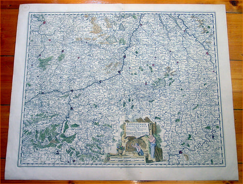
1670 Visscher Large Antique Map of The Liege Region of Belgium - Maastricht
- Title : Leodiensis Episcopatus...Nicolaum Visscher
- Ref #: 60013
- Size: 25in x 21in (635mm x 535mm)
- Date : 1670
- Condition: (A+) Fine Condition
Description:
This large beautifully hand coloured original antique map of Liege Region of Belgium - centering on the Meusa River and the cities of Liege, Maastricht, Namur & Tienen was published by Nicholas Visscher in 1670. (M&B; Tooley)
General Description:
Paper thickness and quality: - Heavy and stable
Paper color: - off white
Age of map color: - Original
Colors used: - Red, yellow, green, blue
General color appearance: - Authentic
Paper size: - 25in x 21in (635mm x 535mm)
Plate size: - 22 1/2in x 18 1/2in (570mm x 470mm)
Margins: - Min 1in (25mm)
Imperfections:
Margins: - None
Plate area: - None
Verso: - None
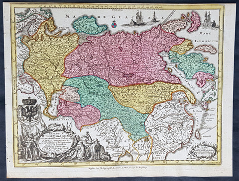
1744 Georg Mattaus Seutter Antique Map of The Russian Empire, China, Japan
- Title : Imperium Russiae Magnae........a Matth. Seutteri...T C Lotter, Geogr.
- Ref #: 93401
- Size: 11in x 8 1/2in (280mm x 215mm)
- Date : 1744
- Condition: (A+) Fine Condition
Description:
This beautifully hand coloured original copper-plate engraved antique map of The Russian Empire was engraved by Tobias Lotter and was published in the 1744 edition of GM Seutters Atlas Minor Prae cipua Orbis Terrarum Imperia Regna et Provincias...., Augsburg, Germany.
General Definitions:
Paper thickness and quality: - Heavy and stable
Paper color : - off white
Age of map color: - Original
Colors used: - Yellow, green, blue, pink
General color appearance: - Authentic
Paper size: - 11in x 8 1/2in (280mm x 215mm)
Plate size: - 10 1/2in x 8in (265mm x 205mm)
Margins: - Min 1/4in (5mm)
Imperfections:
Margins: - None
Plate area: - None
Verso: - None
Background:
Atlas Minor was a series of beautiful maps of all parts of the world. Georg Matthäus Seutter was one of the most and important of the German cartographers of the 18th century, being appointed as the Geographer to the Imperial Court. His son, Albrecht Carl, joined Matthäus and eventually inherited the business. The maps from Atlas Minor were drawn by the two Seutters and engraved by Tobias Conrad Lotte. These maps are highly detailed and engraved with a bold hand with equally strong original hand color in the body of the map as was the 18th century German style. The cartouches were left uncolored in order to emphasize the elaborately detailed illustrations for which German maps are especially prized. These are some of the most decorative and interesting maps of the eighteenth century.
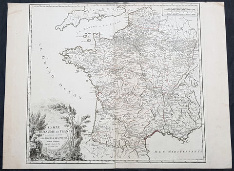
1758 Robert De Vaugondy Large Antique Map of France and Postal Roads
- Title : Carte Du Royame de France ou sont tracees exactement Les Routes Des Postes...1758
- Size: 25 1/2in x 19 1/2in (650mm x 495mm)
- Condition: (A) Very Good Condition
- Date : 1758
- Ref #: 15819
Description:
This large original hand coloured, antique map of France and the postal roads of the day was engraved in 1758 - the date is engraved in the title cartouche - and published by Robert Du Vaugondy in his Atlas Universal, Paris 1757.
General Definitions:
Paper thickness and quality: - Heavy and stable
Paper color : - off white
Age of map color: - Original
Colors used: - Yellow, green, pink
General color appearance: - Authentic
Paper size: - 25 1/2in x 19 1/2in (650mm x 495mm)
Plate size: - 21in x 19 1/2in (535mm x 495mm)
Margins: - Min 1/4in (5mm)
Imperfections:
Margins: - Light age toning
Plate area: - None
Verso: - None
Background:
The Carolingian dynasty ruled France until 987, when Hugh Capet, Duke of France and Count of Paris, was crowned King of the Franks. His descendants—the Capetians, the House of Valois, and the House of Bourbon—progressively unified the country through wars and dynastic inheritance into the Kingdom of France, which was fully declared in 1190 by Philip II Augustus. The French nobility played a prominent role in most Crusades in order to restore Christian access to the Holy Land. French knights made up the bulk of the steady flow of reinforcements throughout the two-hundred-year span of the Crusades, in such a fashion that the Arabs uniformly referred to the crusaders as Franj caring little whether they really came from France. The French Crusaders also imported the French language into the Levant, making French the base of the lingua franca (litt. Frankish language) of the Crusader states. French knights also made up the majority in both the Hospital and the Temple orders. The latter, in particular, held numerous properties throughout France and by the 13th century were the principal bankers for the French crown, until Philip IV annihilated the order in 1307. The Albigensian Crusade was launched in 1209 to eliminate the heretical Cathars in the southwestern area of modern-day France. In the end, the Cathars were exterminated and the autonomous County of Toulouse was annexed into the crown lands of France. Later kings expanded their domain to cover over half of modern continental France, including most of the north, centre and west of France. Meanwhile, the royal authority became more and more assertive, centred on a hierarchically conceived society distinguishing nobility, clergy, and commoners.
From the 11th century, the House of Plantagenet, the rulers of the County of Anjou, succeeded in establishing its dominion over the surrounding provinces of Maine and Touraine, then progressively built an empire that spanned from England to the Pyrenees and covering half of modern France. Tensions between the kingdom of France and the Plantagenet empire would last a hundred years, until Philip Augustus of France conquered between 1202 and 1214 most of the continental possessions of the empire, leaving England and Aquitaine to the Plantagenets. Following the Battle of Bouvines, the Angevin court retreated to England, but persistent Capetian–Plantagenet rivalry would paved the way for another conflict.
Charles IV the Fair died without an heir in 1328. Under the rules of the Salic law the crown of France could not pass to a woman nor could the line of kingship pass through the female line. Accordingly, the crown passed to Philip of Valois, a cousin of Charles, rather than through the female line to Charles nephew, Edward of Plantagenet, who would soon become Edward III of England. During the reign of Philip of Valois, the French monarchy reached the height of its medieval power. Philips seat on the throne was contested by Edward III of England and in 1337, on the eve of the first wave of the Black Death, England and France went to war in what would become known as the Hundred Years War. The exact boundaries changed greatly with time, but French landholdings of the English Kings remained extensive for decades. With charismatic leaders, such as Joan of Arc and La Hire, strong French counterattacks won back English continental territories. Like the rest of Europe, France was struck by the Black Death; half of the 17 million population of France died.
The French Renaissance saw a spectacular cultural development and the first standardisation of the French language, which would become the official language of France and the language of Europes aristocracy. It also saw a long set of wars, known as the Italian Wars, between France and the House of Habsburg. French explorers, such as Jacques Cartier or Samuel de Champlain, claimed lands in the Americas for France, paving the way for the expansion of the First French colonial empire. The rise of Protestantism in Europe led France to a civil war known as the French Wars of Religion, where, in the most notorious incident, thousands of Huguenots were murdered in the St. Bartholomews Day massacre of 1572. The Wars of Religion were ended by Henry IVs Edict of Nantes, which granted some freedom of religion to the Huguenots. Spanish troops, the terror of Western Europe, assisted the Catholic side during the Wars of Religion in 1589–1594, and invaded northern France in 1597; after some skirmishing in the 1620s and 1630s, Spain and France returned to all-out war between 1635 and 1659. The war cost France 300,000 casualties.
Under Louis XIII, the energetic Cardinal Richelieu promoted the centralisation of the state and reinforced the royal power by disarming domestic power holders in the 1620s. He systematically destroyed castles of defiant lords and denounced the use of private violence (dueling, carrying weapons, and maintaining private army). By the end of 1620s, Richelieu established the royal monopoly of force as the doctrine. During Louis XIVs minority and the regency of Queen Anne and Cardinal Mazarin, a period of trouble known as the Fronde occurred in France. This rebellion was driven by the great feudal lords and sovereign courts as a reaction to the rise of royal absolute power in France.
The monarchy reached its peak during the 17th century and the reign of Louis XIV. By turning powerful feudal lords into courtiers at the Palace of Versailles, Louis XIVs personal power became unchallenged. Remembered for his numerous wars, he made France the leading European power. France became the most populous country in Europe and had tremendous influence over European politics, economy, and culture. French became the most-used language in diplomacy, science, literature and international affairs, and remained so until the 20th century. France obtained many overseas possessions in the Americas, Africa and Asia. Louis XIV also revoked the Edict of Nantes, forcing thousands of Huguenots into exile.
Under Louis XV, Louis XIVs great-grandson, France lost New France and most of its Indian possessions after its defeat in the Seven Years War (1756–63). Its European territory kept growing, however, with notable acquisitions such as Lorraine (1766) and Corsica (1770). An unpopular king, Louis XVs weak rule, his ill-advised financial, political and military decisions – as well as the debauchery of his court– discredited the monarchy, which arguably paved the way for the French Revolution 15 years after his death.
Louis XVI, Louis XVs grandson, actively supported the Americans, who were seeking their independence from Great Britain (realised in the Treaty of Paris (1783)). The financial crisis aggravated by Frances involvement in the American Revolutionary War was one of many contributing factors to the French Revolution. Much of the Enlightenment occurred in French intellectual circles, and major scientific breakthroughs and inventions, such as the discovery of oxygen (1778) and the first hot air balloon carrying passengers (1783), were achieved by French scientists. French explorers, such as Bougainville and Lapérouse, took part in the voyages of scientific exploration through maritime expeditions around the globe. The Enlightenment philosophy, in which reason is advocated as the primary source for legitimacy and authority, undermined the power of and support for the monarchy and helped pave the way for the French Revolution.
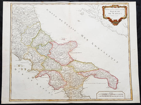
1757 Robert De Vaugondy Large Antique Map Southern Italy Mezzogiorno, 2 Sicilies
- Title : Partie Septentrionale Du Royaume De Naples
- Size: 26in x 19 1/2in (660mm x 495mm)
- Condition: (A+) Fine Condition
- Date : 1757
- Ref #: 92771
Description:
This magnificent hand coloured original copper-plate engraved antique map of Southern Italy in the mid to late 18th century by Robert De Vaugondy was published in the 1757 edition of De Vaugondys famous The Atlas Universel
General Definitions:
Paper thickness and quality: - Heavy and stable
Paper color : - off white
Age of map color: - Original & later
Colors used: - Blue, pink, red, green, yellow
General color appearance: - Authentic
Paper size: - 26in x 19 1/2in (660mm x 495mm)
Plate size: - 24 1/2in x 19 1/2in (620mm x 495mm)
Margins: - Min 1/4in (5mm)
Imperfections:
Margins: - None
Plate area: - None
Verso: - None
Background:
Southern Italy or Mezzogiorno is a macroregion of Italy traditionally encompassing the territories of the former Kingdom of the two Sicilies (all the southern section of the Italian Peninsula and Sicily), with the frequent addition of the island of Sardinia.
In 1442, however, Alfonso V conquered the Kingdom of Naples and unified Sicily and Naples once again as dependencies of the Crown of Aragon. At his death in 1458, the kingdom was again separated and Naples was inherited by Ferrante, Alfonso\'s illegitimate son. When Ferrante died in 1494, Charles VIII of France invaded Italy, using the Angevin claim to the throne of Naples, which his father had inherited on the death of King René\'s nephew in 1481, as a pretext, thus beginning the Italian Wars. Charles VIII expelled Alfonso II of Naples from Naples in 1495, but was soon forced to withdraw due to the support of Ferdinand II of Aragon for his cousin, Alfonso IIs son Ferrantino. Ferrantino was restored to the throne, but died in 1496, and was succeeded by his uncle, Frederick IV. The French, however, did not give up their claim, and in 1501 agreed to a partition of the kingdom with Ferdinand of Aragon, who abandoned his cousin King Frederick. The deal soon fell through, however, and the Crown of Aragon and France resumed their war over the kingdom, ultimately resulting in an Aragonese victory leaving Ferdinand in control of the kingdom by 1504.
The kingdom continued to be a focus of dispute between France and Spain for the next several decades, but French efforts to gain control of it became feebler as the decades went on, and Spanish control was never genuinely endangered. The French finally abandoned their claims to the kingdom by the Treaty of Cateau-Cambrésis in 1559. With the Treaty of London (1557) the new client state of Stato dei Presidi (State of Presidi) was established and governed directly by Spain, as part of the Kingdom of Naples.
The administration of the Kingdom of Naples and Sicily, as well as the Duchy of Milan, was then run by the Council of Italy, while Sardinia kept being an integral part of the Council of Aragon until the first years of the XVIII° century, when it was ceded to Austria and eventually Savoy.
After the War of the Spanish Succession in the early 18th century, possession of the kingdom again changed hands. Under the terms of the Treaty of Utrecht in 1713, Naples was given to Charles VI, the Holy Roman Emperor. He also gained control of Sicily in 1720, but Austrian rule did not last long. Both Naples and Sicily were conquered by a Spanish army during the War of the Polish Succession in 1734, and Charles, Duke of Parma, a younger son of King Philip V of Spain was installed as King of Naples and Sicily from 1735. When Charles inherited the Spanish throne from his older half-brother in 1759, he left Naples and Sicily to his younger son, Ferdinand IV. Despite the two kingdoms being in a personal union under the House of Bourbon from 1735 onwards, they remained constitutionally separated.
Being a member of the House of Bourbon, King Ferdinand IV was a natural opponent of the French Revolution and Napoleon. In January 1799, Napoleon Bonaparte, in the name of the French Republic, captured Naples and proclaimed the Parthenopaean Republic, a French client state, as successor to the kingdom. King Ferdinand fled from Naples to Sicily until June of that year. In 1806, Bonaparte, by then French Emperor, again dethroned King Ferdinand and appointed his brother, Joseph Bonaparte, as King of Naples. In the Edict of Bayonne of 1808, Napoleon removed Joseph to Spain and appointed his brother-in-law, Joachim Murat, as King of the Two Sicilies, though this meant control only of the mainland portion of the kingdom. Throughout this Napoleonic interruption, King Ferdinand remained in Sicily, with Palermo as his capital.
After Napoleon\'s defeat, King Ferdinand IV was restored by the Congress of Vienna of 1815 as Ferdinand I of the Two Sicilies. He established a concordat with the Papal States, which previously had a claim to the land. There were several rebellions on the island of Sicily against the King Ferdinand II but the end of the kingdom was only brought about by the Expedition of the Thousand in 1860, led by Garibaldi, an icon of the Italian unification, with the support of the House of Savoy and their Kingdom of Sardinia. The expedition resulted in a striking series of defeats for the Sicilian armies against the growing troops of Garibaldi. After the capture of Palermo and Sicily, he disembarked in Calabria and moved towards Naples, while in the meantime the Piedmontese also invaded the Kingdom from the Marche. The last battles fought were that of the Volturnus in 1860 and the siege of Gaeta, where King Francis II had sought shelter, hoping for French help, which never came. The last towns to resist Garibaldi\'s expedition were Messina (which capitulated on 13 March 1861) and Civitella del Tronto (which capitulated on 20 March 1861). The Kingdom of the Two Sicilies was dissolved and annexed to the new Kingdom of Italy, founded in the same year. (Ref: Tooley; M&B)

1856 A H Dufour Very Large Antique Political map of Europe - Mountains
- Title : Carte Generale L Europe Actuelle Dressee A H Dufour Gravee CH Dyonnet..1856
- Ref #: 61020
- Size: 33in x 24in (840mm x 610mm)
- Date : 1856
- Condition: (A+) Fine Condition
Description:
This very large, magnificent hand coloured original copper plate antique map of the political borders of Europe in the mid 19th century - with a list of European mountains at the bottom of the map - by Adolphe Hippolyte Dufour was engraved by Charles Dyonnet in 1856 - dated in the title - for Dufours 1860 edition of his monumental elephant folio Atlas Physique, Historique et Politique Geographie Moderne published by Pauline Et La Chevalier, Paris.
The 19th century French cartographer Auguste-Henri Dufour began publishing the dramatic elephant folio Atlas Universel, also occasionally titled Grand Atlas Universal, around 1855. Several editions appeared between its initial publication in the 1850s and a final run c. 1870. The 1863 and 1864 editions in particular are highly desirable among collectors because the United States and North America maps illustrate the proposed, but unrealized, state of Corona (roughly modern day Utah). The atlas contained roughly 40 maps, most of which were engraved by Louis Antoine (the maps) and Deletre (typography) under the supervision of Charles Dyonnet, official engraver of the Depot de la Marine. The Atlas Universal was published in Paris and edited by the firm of Paulin et le Chevalier, 60 Rue Richelieu.
General Definitions:
Paper thickness and quality: - Heavy and stable
Paper color : - off white
Age of map color: - Original
Colors used: - Yellow, green, blue, pink
General color appearance: - Authentic
Paper size: - 33in x 24in (840mm x 610mm)
Plate size: - 33in x 24in (840mm x 610mm)
Margins: - Min 1in (25mm)
Imperfections:
Margins: - Light age toning in margins
Plate area: - None
Verso: - None
Background:
Charles Dyonnet 1822 - 1880 was an extremely active Paris based engraver working in the mid to late 19th century. From his offices at 220 Rue St. Jacques, Paris, Dyonnet engraved numerous maps for many of the most prominent 19th French cartographic publishers including Vuillemin, Dufour, Fremin and Duvotenay. From 1850-1861, he held the coveted position of Graveur du Dépot de la Marine, and in this position engraved numerous French naval and military maps. Dyonnet had a detail oriented and aesthetically minded hand and is responsible from some of the most beautiful French maps to emerge during the 19th century. (Ref: M&B; Tooley)
1728 Hermann Moll Large Antique Map and View of Gibraltar - 2nd Spanish Seige
- Title : A New and Exact plan of Gibraltar with all its fortifications as they are at present….
- Ref #: 40838
- Size: 25in x 11in (635mm x 280mm)
- Date : 1727
- Condition: (B) Good Condition
Description:
This finely engraved original antique map and view of the second Spanish siege of Gibraltar by Herman Moll was published in 1727.
Although undated, the legend at the top left of the map, gives an in-depth explanation to the map including no. 5 that refers to 'Place where at this time Barracks building for a Regiment Ap: 15. 1726. 6. The Great Church.', while the dedication is to David Colyear, 1st Earl of Portmore, Governor of Gibraltar. The plan was presumably engraved either in anticipation of, or during the second Spanish siege; Portmore was in England when the siege began, but sailed there with a relief force, arriving on 1st May, 1727. British command of the sea, coupled with the natural features of the Rock of Gibraltar on the landward side of the peninsula, combined to thwart Spanish ambition, and the siege petered to an end in 1728, with the garrison never seriously troubled.
Background: Gibraltar became part of the Visigothic Kingdom of Hispania following the collapse of the Roman Empire and came under Muslim Moorish rule in 711 AD. It was permanently settled for the first time by the Moors and was renamed Jebel Tariq – the Mount of Tariq, later corrupted into Gibraltar. The Christian Crown of Castile annexed it in 1309, lost it again to the Moors in 1333 and finally regained it in 1462. Gibraltar became part of the unified Kingdom of Spain and remained under Spanish rule until 1704. It was captured during the War of the Spanish Succession by an Anglo-Dutch fleet in the name of Charles VI of Austria, the Habsburg contender to the Spanish throne. At the war's end, Spain ceded the territory to Britain under the terms of the Treaty of Utrecht of 1713.
Spain tried to regain control of Gibraltar, which Britain had declared a Crown colony, through military, diplomatic and economic pressure. Gibraltar was besieged and heavily bombarded during three wars between Britain and Spain but the attacks were repulsed on each occasion. By the end of the last siege, in the late 18th century, Gibraltar had faced fourteen sieges in 500 years. In the years after Trafalgar, Gibraltar became a major base in the Peninsular War. The colony grew rapidly during the 19th and early 20th centuries, becoming one of Britain's most important possessions in the Mediterranean. It was a key stopping point for vessels en route to India via the Suez Canal. A large British naval base was constructed there at great expense at the end of the 19th century and became the backbone of Gibraltar's economy.
British control of Gibraltar enabled the Allies to control the entrance to the Mediterranean during the Second World War. It was attacked on several occasions by German, Italian and Vichy French forces, though without causing much damage. The Spanish dictator General Francisco Franco declined to join a Nazi plan to occupy Gibraltar but revived Spain's claim to the territory after the war. As the territorial dispute intensified, Spain closed its border with Gibraltar between 1969 and 1985 and communications links were severed. Spain's position was supported by Latin American countries but was rejected by Britain and the Gibraltarians themselves, who vigorously asserted their right to self-determination. Discussions of Gibraltar's status have continued between Britain and Spain but have not reached any conclusion.
Shortly after Gibraltar's recapture, King Henry IV of Castile declared it Crown property and reinstituted the special privileges which his predecessor had granted during the previous period of Christian rule. Four years after visiting Gibraltar in 1463, he was overthrown by the Spanish nobility and clergy. His half-brother Alfonso was declared king and rewarded Medina Sidonia for his support with the lordship of Gibraltar. The existing governor, a loyalist of the deposed Henry IV, refused to surrender Gibraltar to Medina Sidonia. After a fifteen-month siege from April 1466 to July 1467, Medina Sidonia took control of the town. He died the following year but his son Enrique was confirmed as lord of Gibraltar by the reinstated Henry IV in 1469. In 1474 the new Duke of Medina Sidonia sold Gibraltar to a group of Jewish conversos from Cordova and Seville led by Pedro de Herrera in exchange for maintaining the garrison of the town for two years, after which time the 4,350 conversos were expelled by the Duke. His status was further enhanced by Isabella I of Castile in 1478 with the granting of the Marquisate of Gibraltar.
On 2 January 1492, after five years of war, the Moorish emirate in Spain came to an end with the Catholic Monarchs' capture of Granada. The Jews of Gibraltar were, like those elsewhere in the kingdom, expelled from Spain by order of the monarchs in March that year. Gibraltar was used by Medina Sidonia as a base for the Spanish capture of Melilla in North Africa in 1497. Two years later the Muslims of Granada were ordered to convert to Christianity or leave. Those that did not convert left for North Africa, some of them travelling via Gibraltar.
Gibraltar became Crown property again in 1501 at the order of Isabella and the following year it received a new set of royal arms, which is still used by modern Gibraltar, replacing those of Medina Sidonia. In the Royal Warrant accompanying the arms, Isabella highlighted Gibraltar's importance as "the key between these our kingdoms in the Eastern and Western Seas [the Mediterranean and Atlantic]". The metaphor was represented on the royal arms by a golden key hanging from the front gate of a battlemented fortress. The warrant charged all future Spanish monarchs to "hold and retain the said City for themselves and in their own possession; and that no alienation of it, nor any part of it, nor its jurisdiction ... shall ever be made from the Crown of Castile."
At this point in history, "Gibraltar" meant not just the peninsula but the entire surrounding area including the land on which the towns of La Línea de la Concepción, San Roque, Los Barrios and Algeciras now stand. To the east, Gibraltar was bounded by the Guadiaro River, and its northern boundaries lay in the vicinity of Castellar de la Frontera, Jimena de la Frontera, Alcalá de los Gazules, Medina-Sidonia and Tarifa. From the 16th century, the modern meaning of the name came to be adopted – specifically referring only to the town of Gibraltar and the peninsula on which it stands.
Under Spanish Crown rule, the town of Gibraltar fell into severe decline. The end of Muslim rule in Spain and the Christian capture of the southern ports considerably decreased the peninsula's strategic value. It derived some minor economic value from tuna-fishing and wine-producing industries but its usefulness as a fortress was now limited. It was effectively reduced to the status of an unremarkable stronghold on a rocky promontory and Marbella replaced it as the principal Spanish port in the region.
Gibraltar's inhospitable terrain made it an unpopular place to live. To boost the population, convicts from the kingdom of Granada were offered the possibility of serving their sentence in the Gibraltar garrison as an alternative to prison. Despite its apparent unattractiveness, Juan Alfonso de Guzmán, third Duke of Medina Sidonia, nonetheless sought to regain control of the town. In September 1506, following Isabella's death, he laid siege in the expectation that the gates would quickly be opened to his forces. This did not happen, and after a fruitless four-month blockade he gave up the attempt. Gibraltar received the title of "Most Loyal" from the Spanish crown in recognition of its faithfulness (Ref: M&B, Tooley)
General Description:
Paper thickness and quality: - Heavy and stable
Paper color: - off white
Age of map color: -
Colors used: -
General color appearance: -
Paper size: - 25in x 11in (635mm x 280mm)
Plate size: - 25in x 11in (635mm x 280mm)
Margins: - Min 1/4in (5mm)
Imperfections:
Margins: - None
Plate area: - Small loss to the very right figure in the title cartouche not affecting the map, light creasing along folds as issued
1691 Coronelli Large Antique Map of The Liege Region of Belgium - Maastricht
- Title : Vescovato di Leige
- Ref #: 16271
- Size: 27in x 19 1/2in (685mm x 495mm)
- Date : 1691
- Condition: (A+) Fine Condition
Description
This large, fine, scarce & beautifully hand coloured original antique map of the Liege Region of Belgium - centering on the Meusa River and the cities of Liege, Maastricht, Namur & Tienen - was published by Vincenzo Maria Coronelli (1650-1718) in 1691.
Coronelli was one of the finest engravers & cartographers of any era, producing some of the most stunning work ever seen. This is evident in this beautiful map. He was a master craftsman with an eye for detail. You can feel the uncompromising accuracy & passion in his work when you study his maps & globes. (Ref: Shirley; Tooley; M&B)
General Description:
Paper thickness and quality: - Heavy and stable
Paper color: - white
Age of map color: - Early
Colors used: - Green, yellow, pink, blue
General color appearance: - Authentic
Paper size: - 27in x 19 1/2in (685mm x 495mm)
Plate size: - 24 1/2in x 19in (620mm x 485mm)
Margins: - min. 1/2in (10mm)
Imperfections:
Margins: - None
Plate area: - Light age toning along centerfold
Verso: - 3 small repairs along centerfold